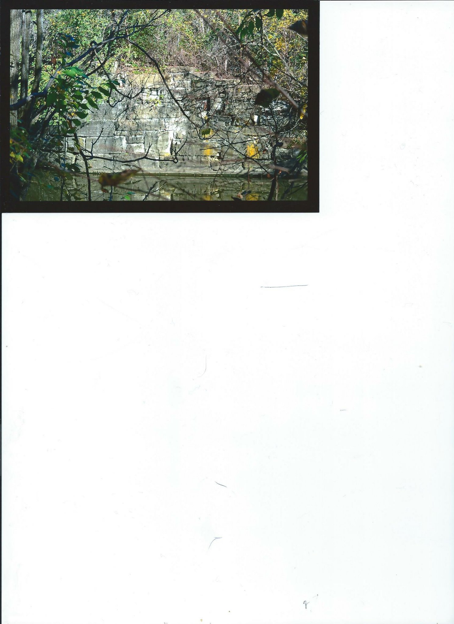
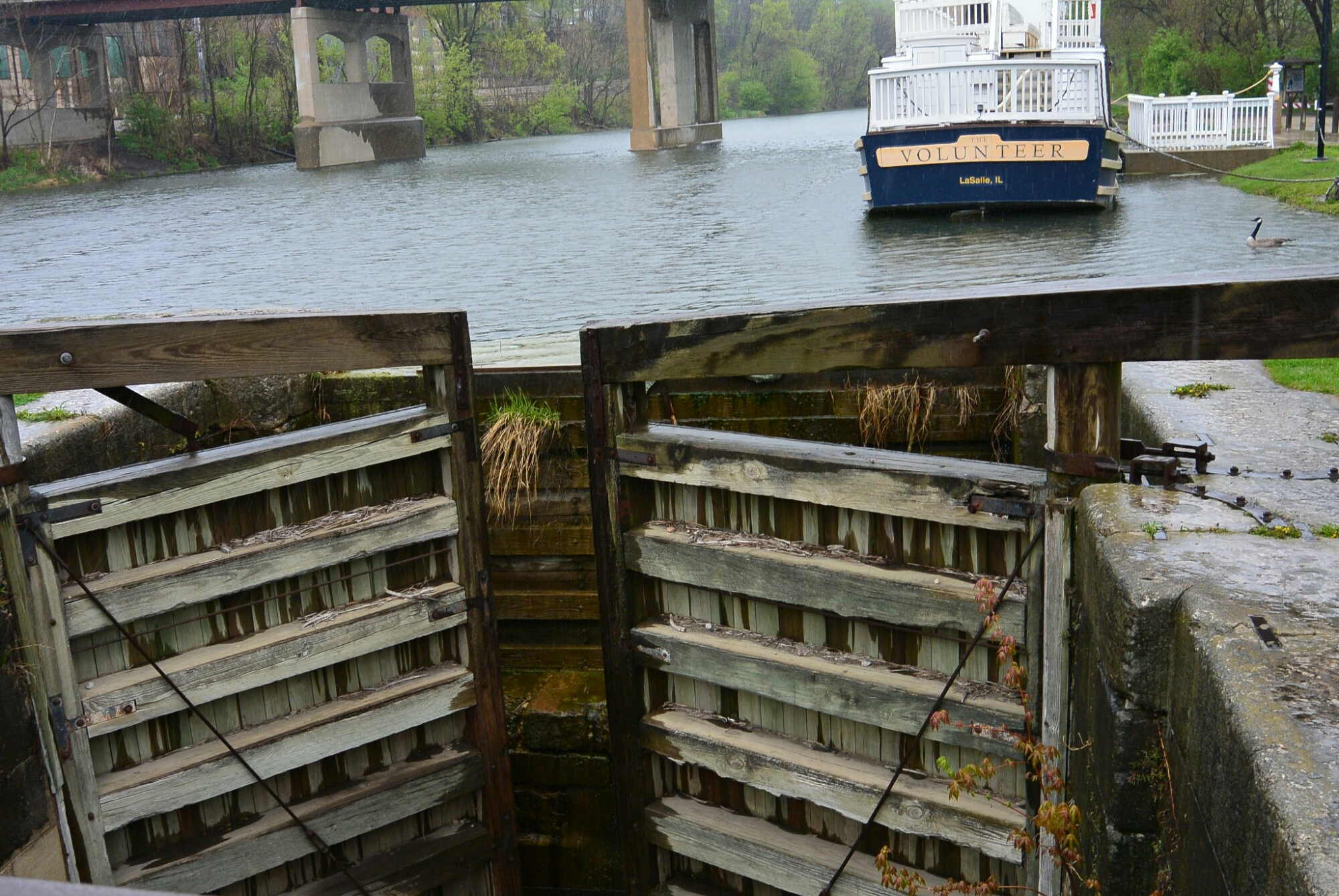
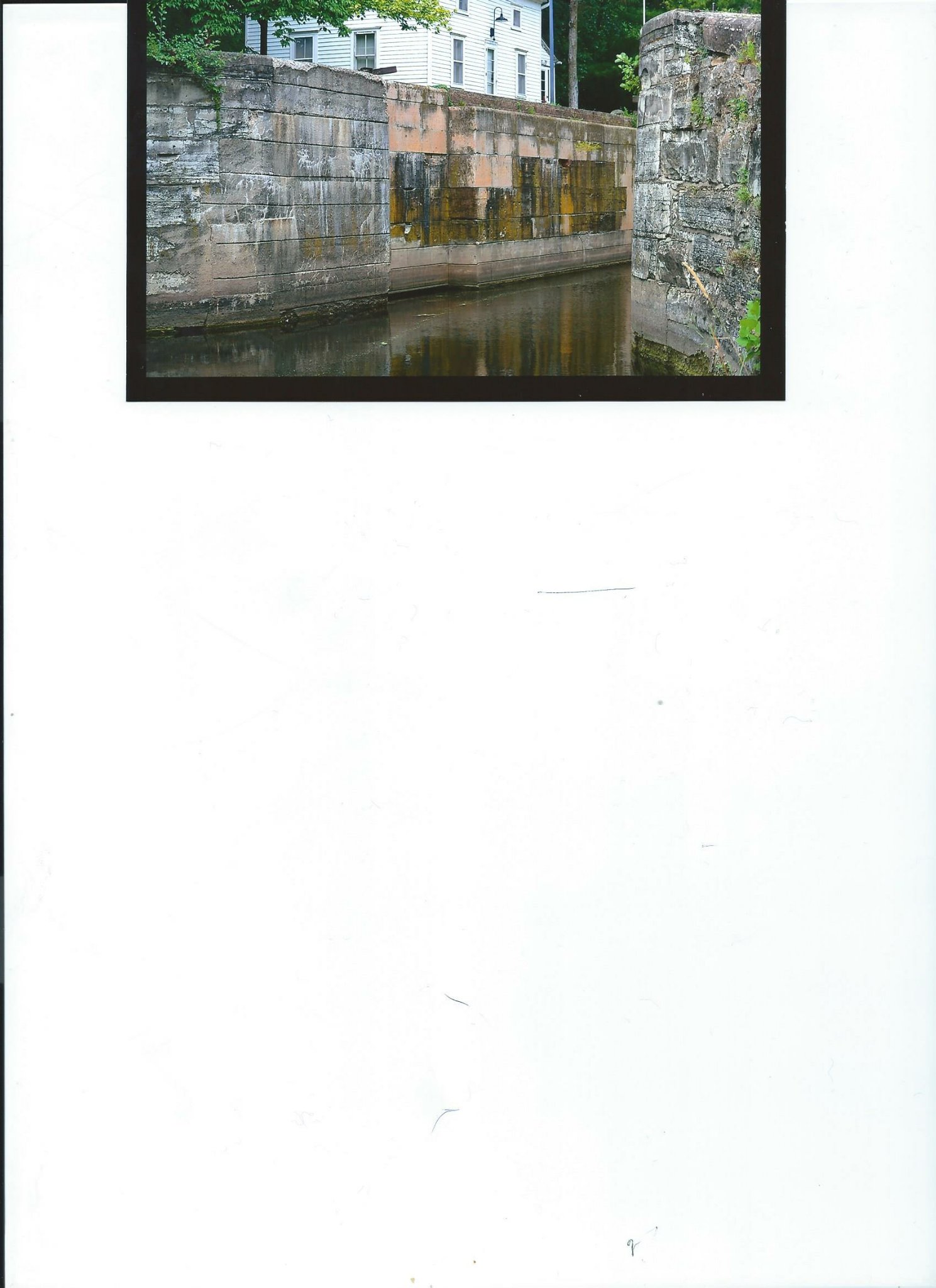
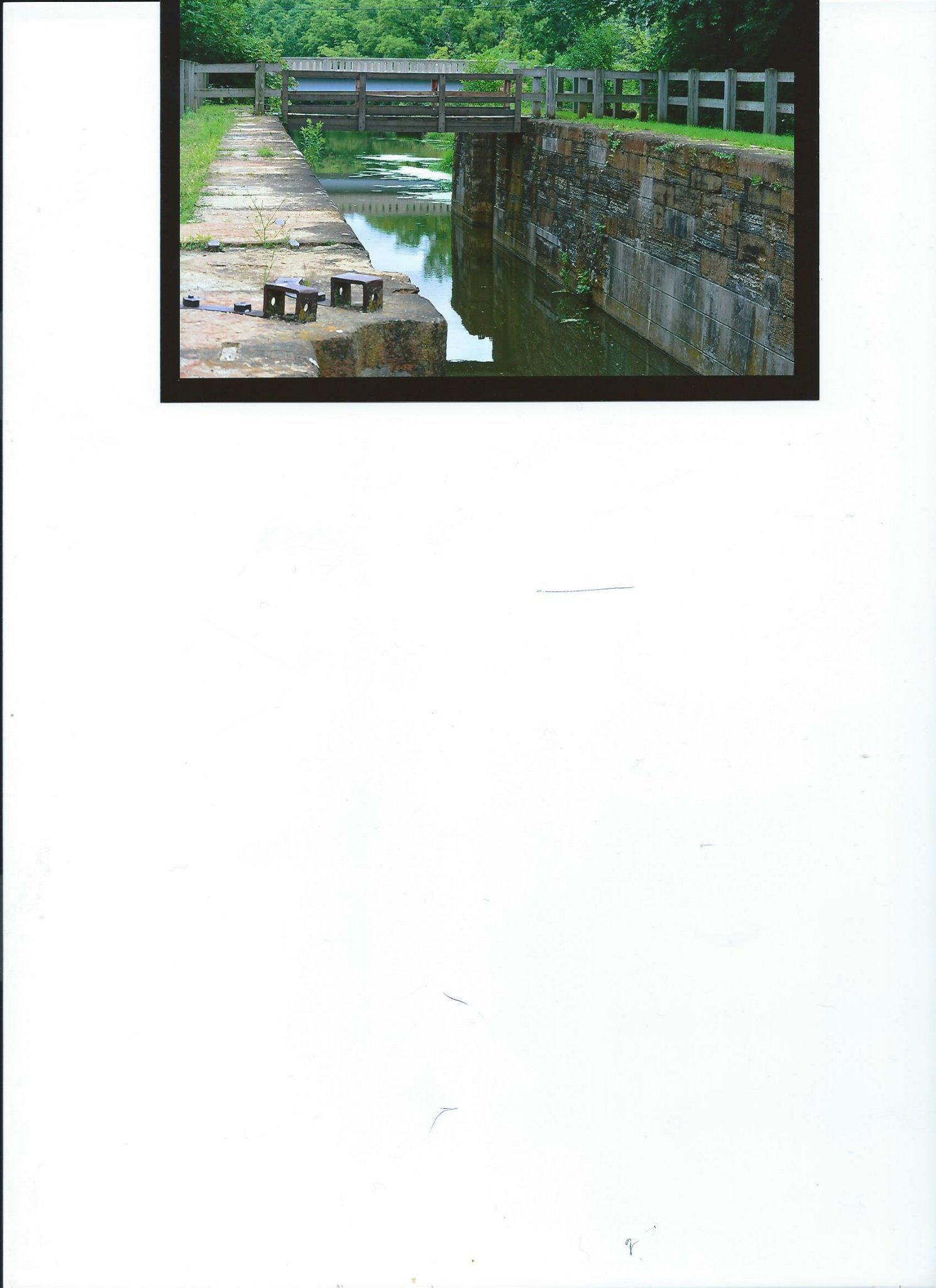
Recently, I was able to obtain new views of Lock 2.

Lock2
Lock 2
Lock 2
As can be seen, there is water in the lock. No lock gates are present. The area is difficult to visualize due to obscuring trees and bushes
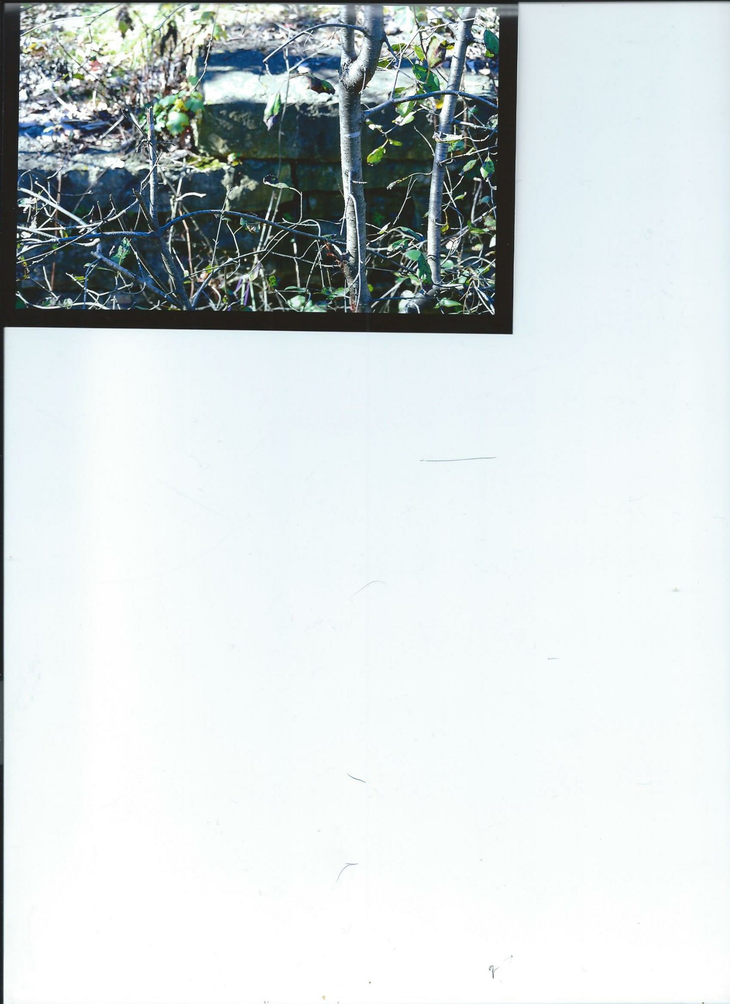
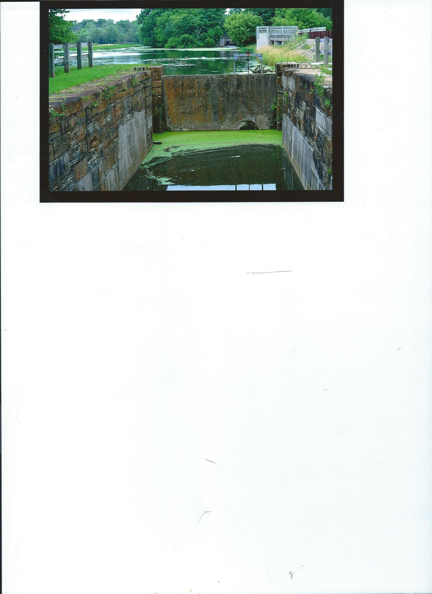
Recently, I was able to obtain new views of Lock 2.
Lock2
Lock 2
Lock 2
As can be seen, there is water in the lock. No lock gates are present. The area is difficult to visualize due to obscuring trees and bushes

Electric Line Train Station Dellwood Park

Old Photograph Dellwood Park
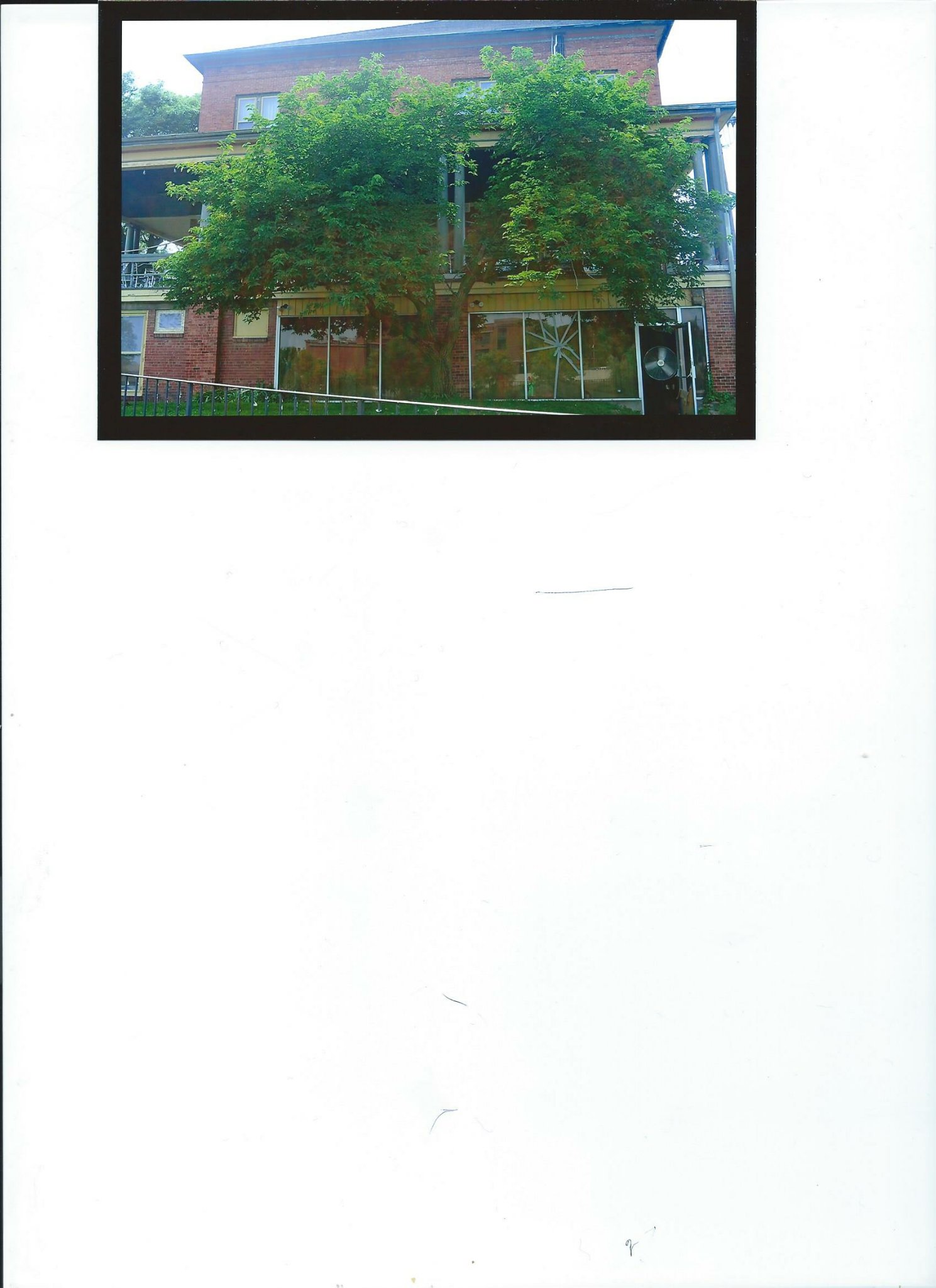
This last Wednesday, I was walking along the Illinois Michigan Canal in Lockport towards Joliet. As I walked south, I encountered a sign for Dellwood Park. Not knowing much about this area, I decided to investigate and do research. I have enclosed my photographs.
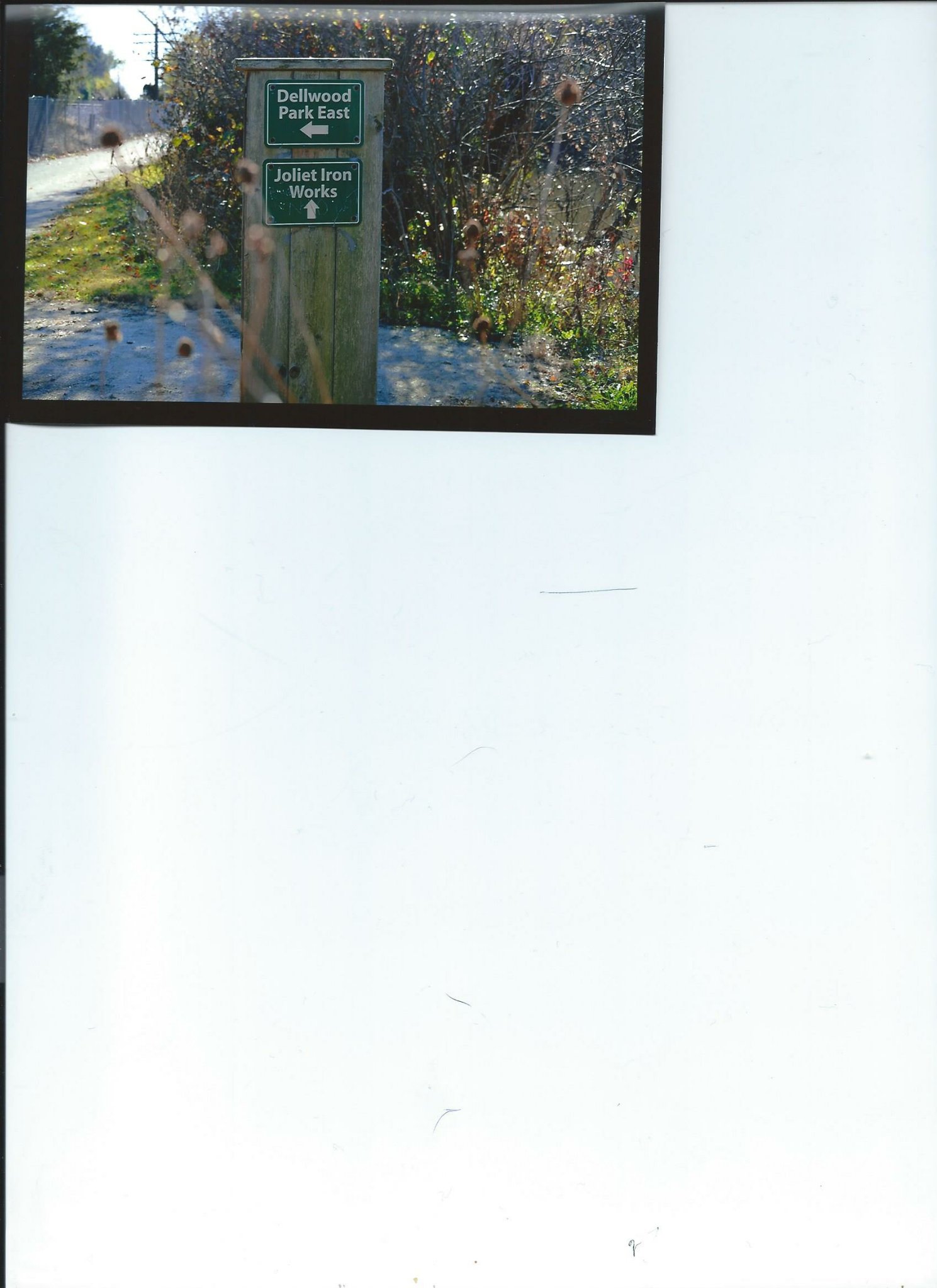
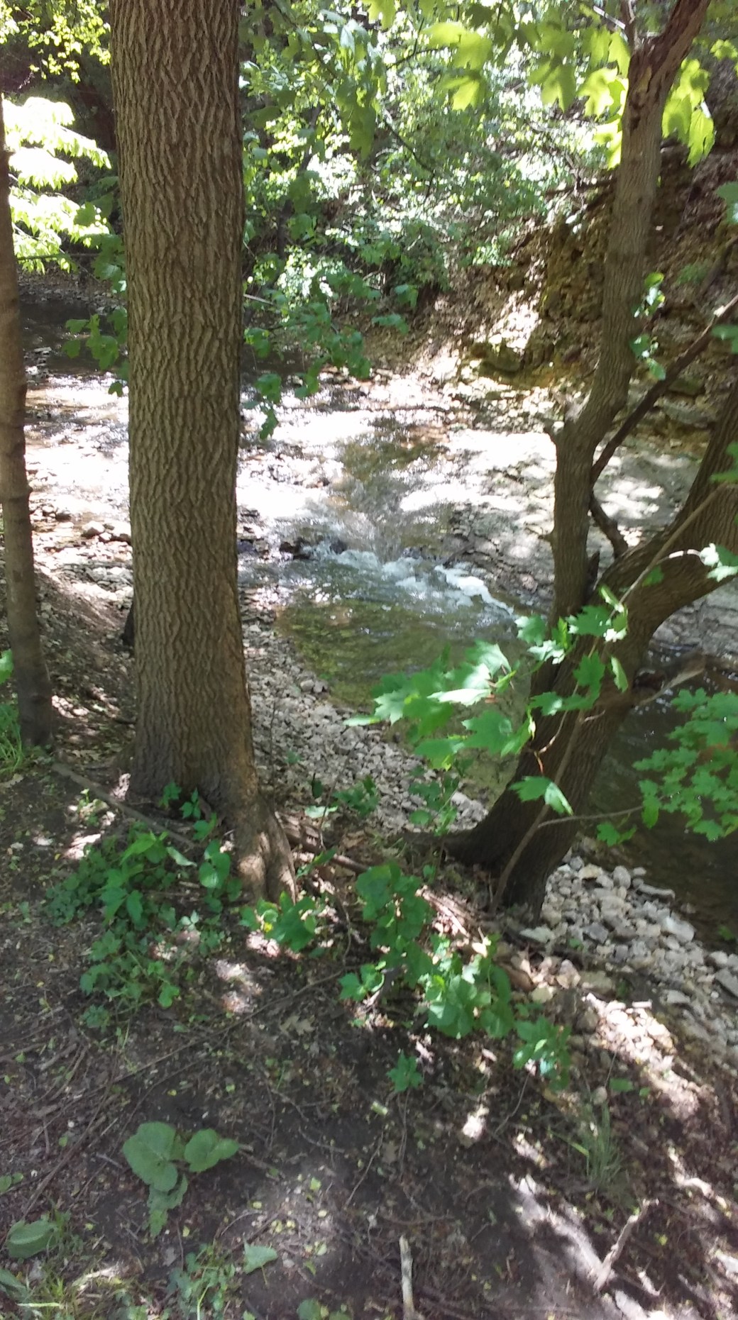
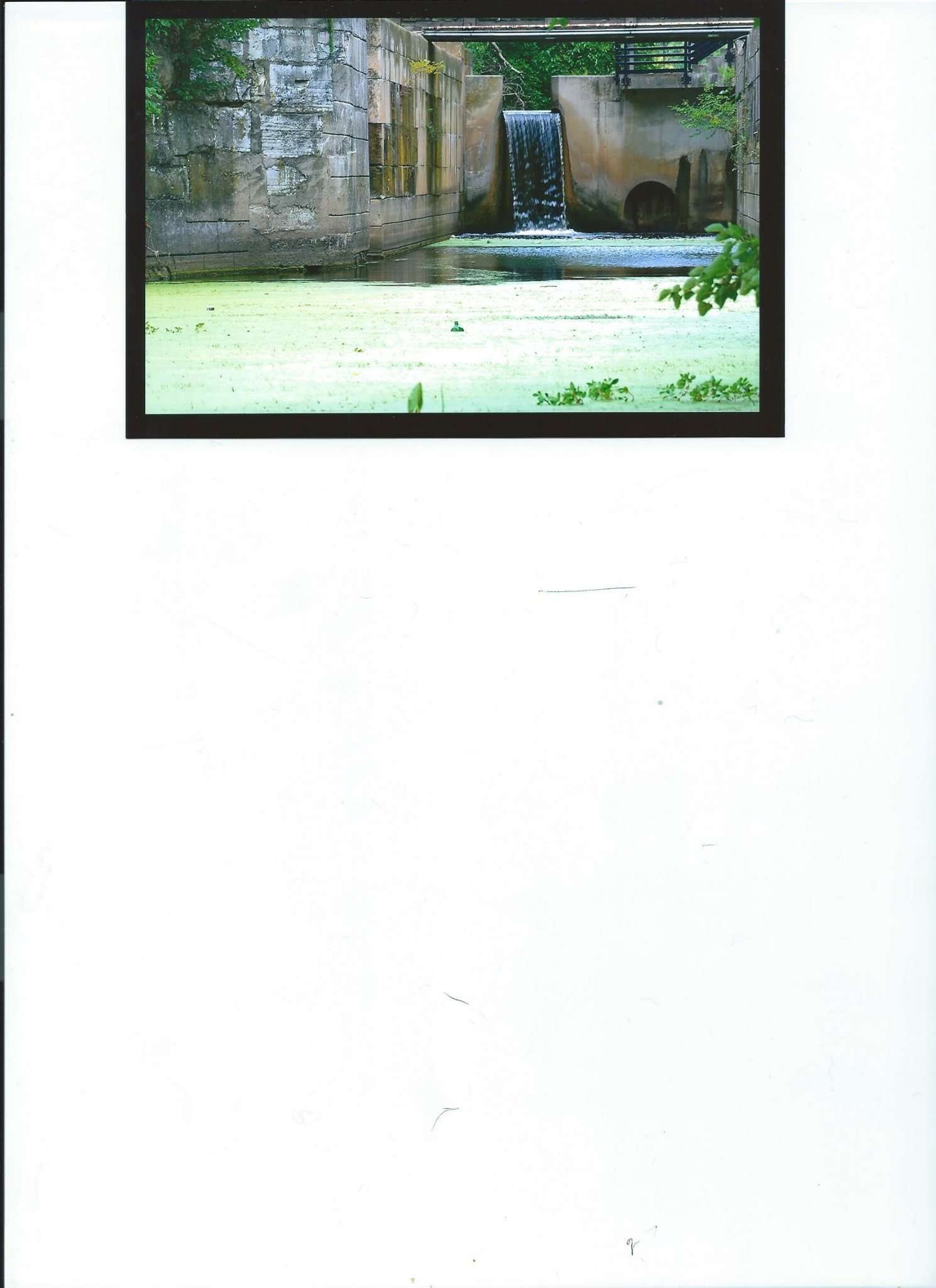
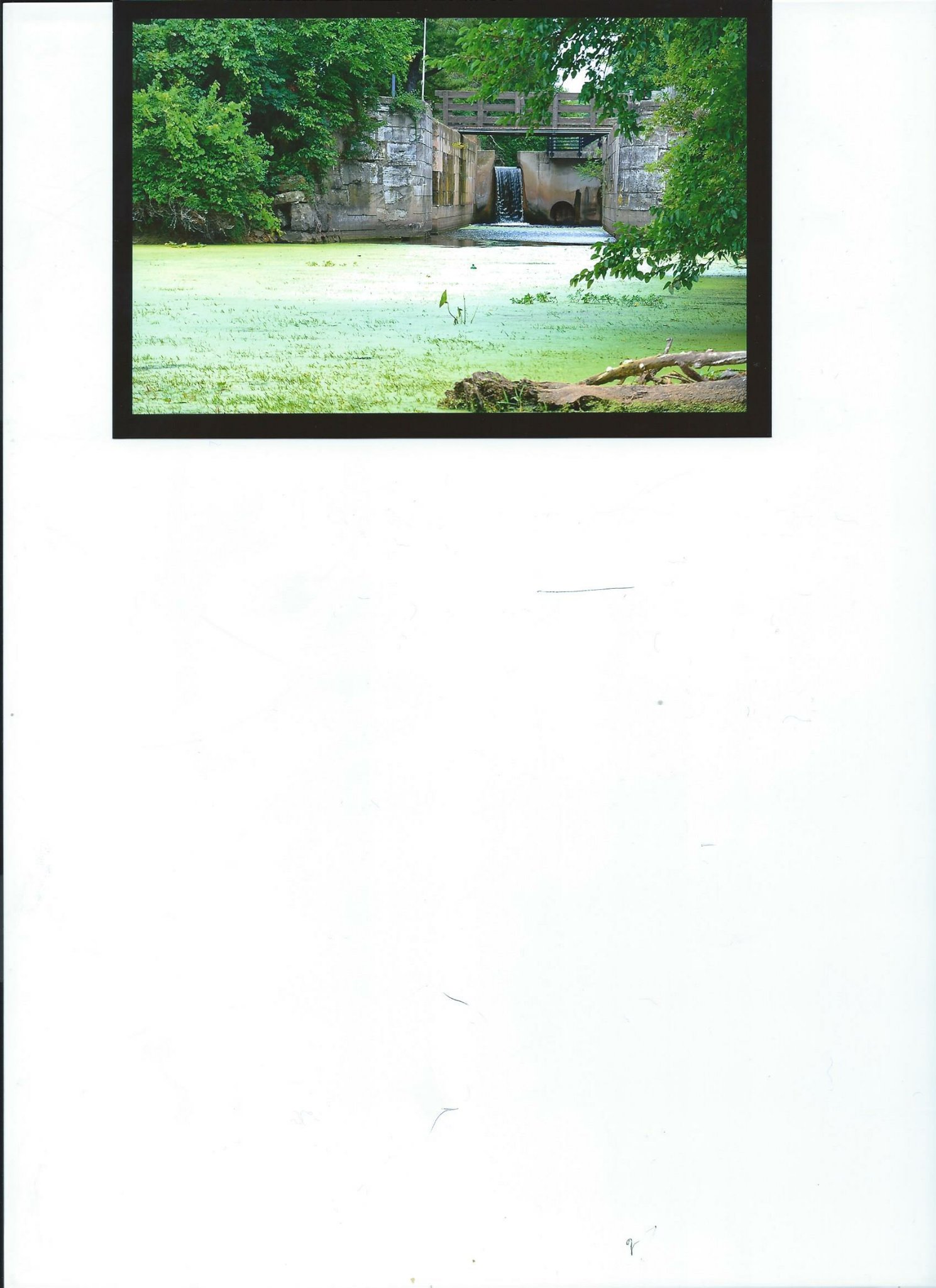
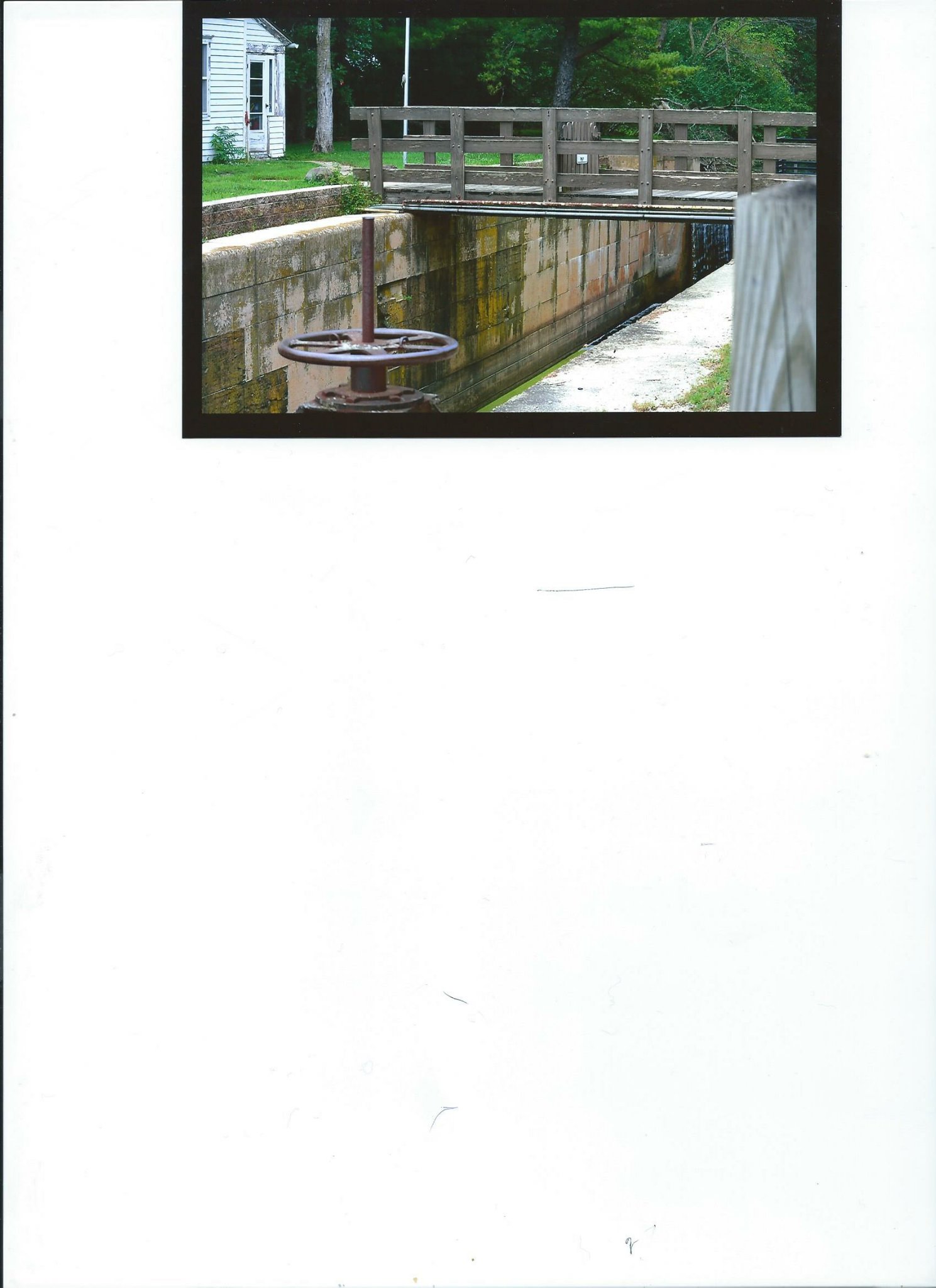
Dellwood Park was constructed in 1905 by the Chicago and Joliet Electric Railway Company. This was developed as a means to increase ridership. Construction costs were approximately $300,000. Included in the park were a man made lagoon (created by damming the Fraction Run Creek), waterfall, boat house, dance hall, grandstand for races, merry go round, open air theatre, and a restaurant.

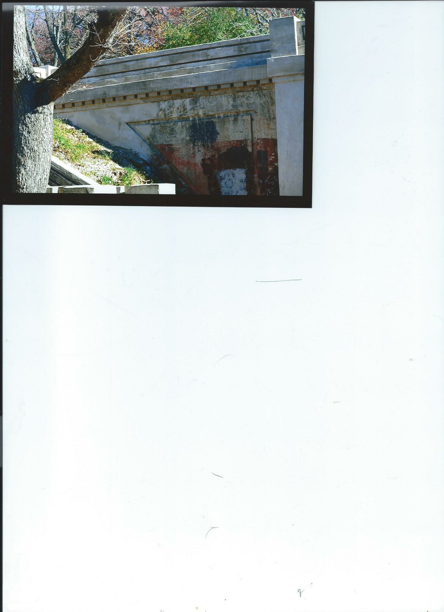
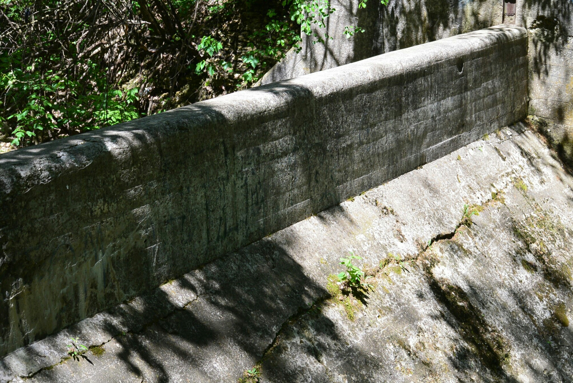
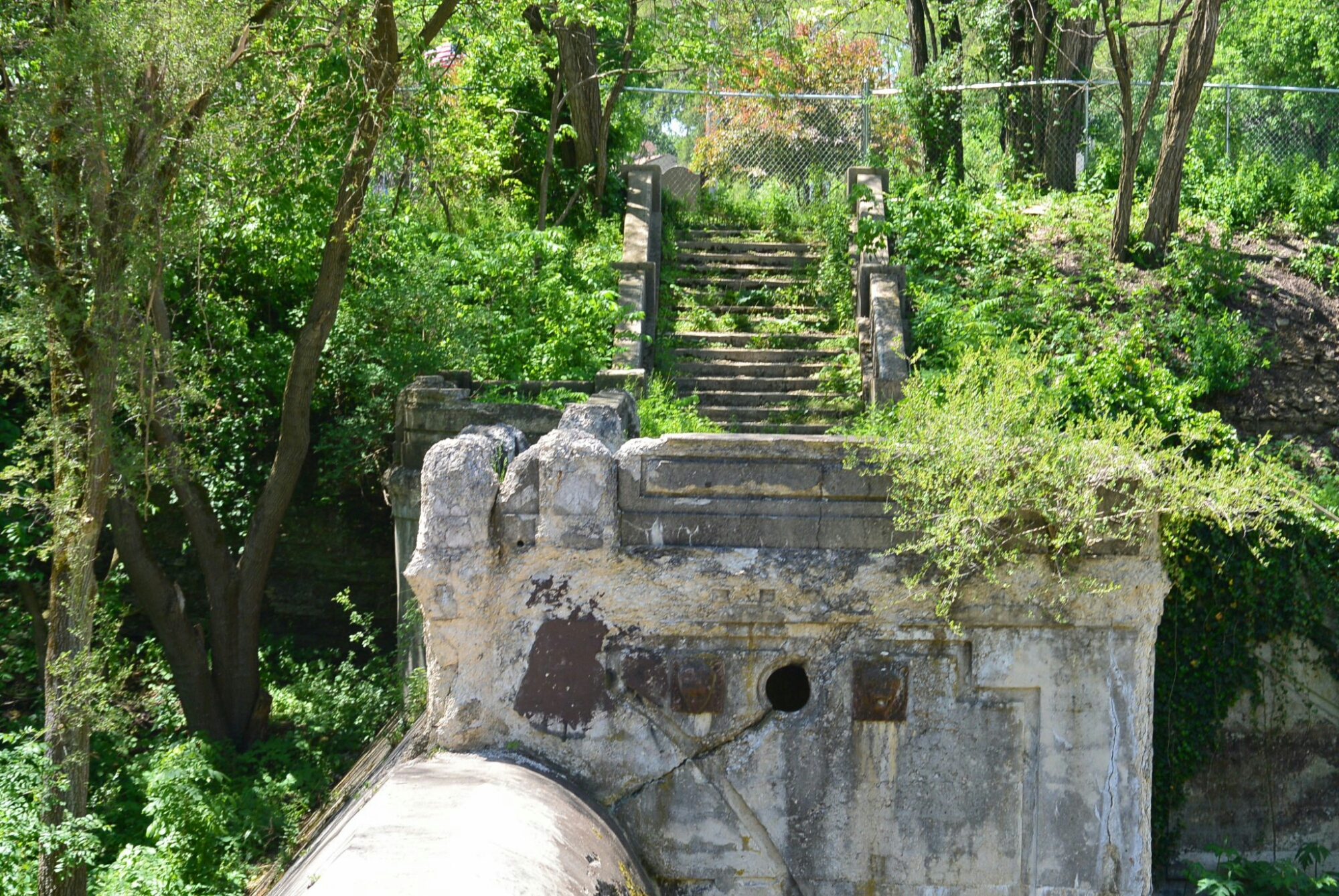
Portion of Dam Dellwood Park
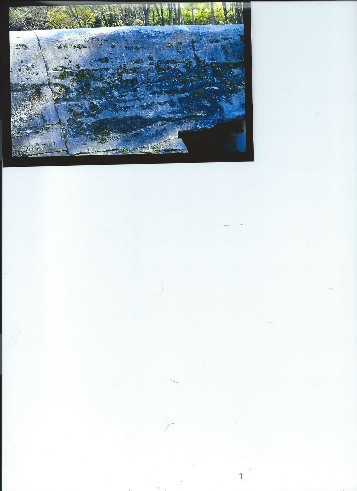
Dam

Limestone Cliffs Dellwood Park
Dellwood Park

Dellwood Park

Dellwood Park
The Park became a great success. Thousands of people attended on week ends.
It was in operation for about 30 years. It was eventually abandoned. The boat house burned down in the late 1930’s. The dam and other structures remain.
Additional photos from 5/2017
Dam Dellwood Park
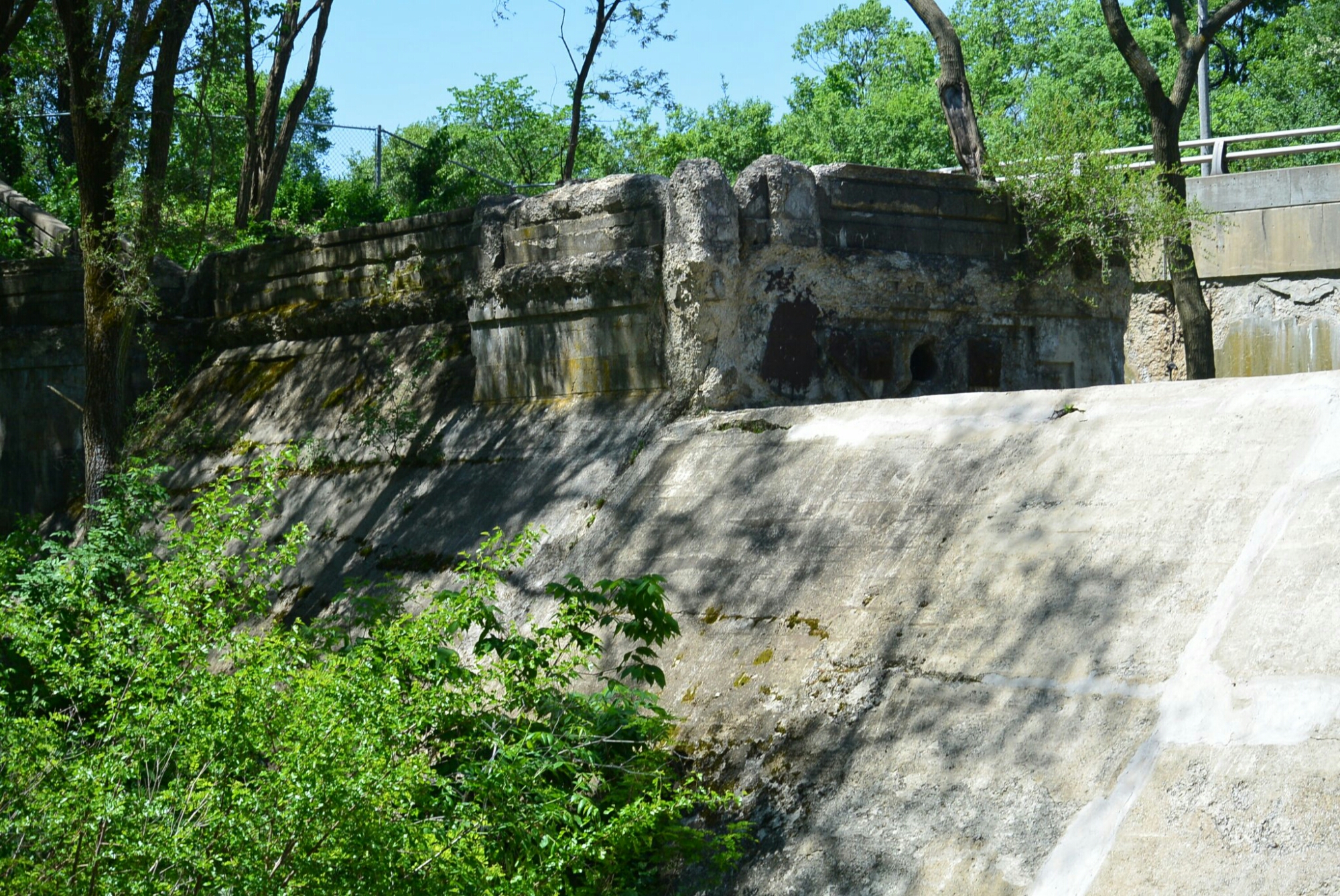
Dam Dellwood Park
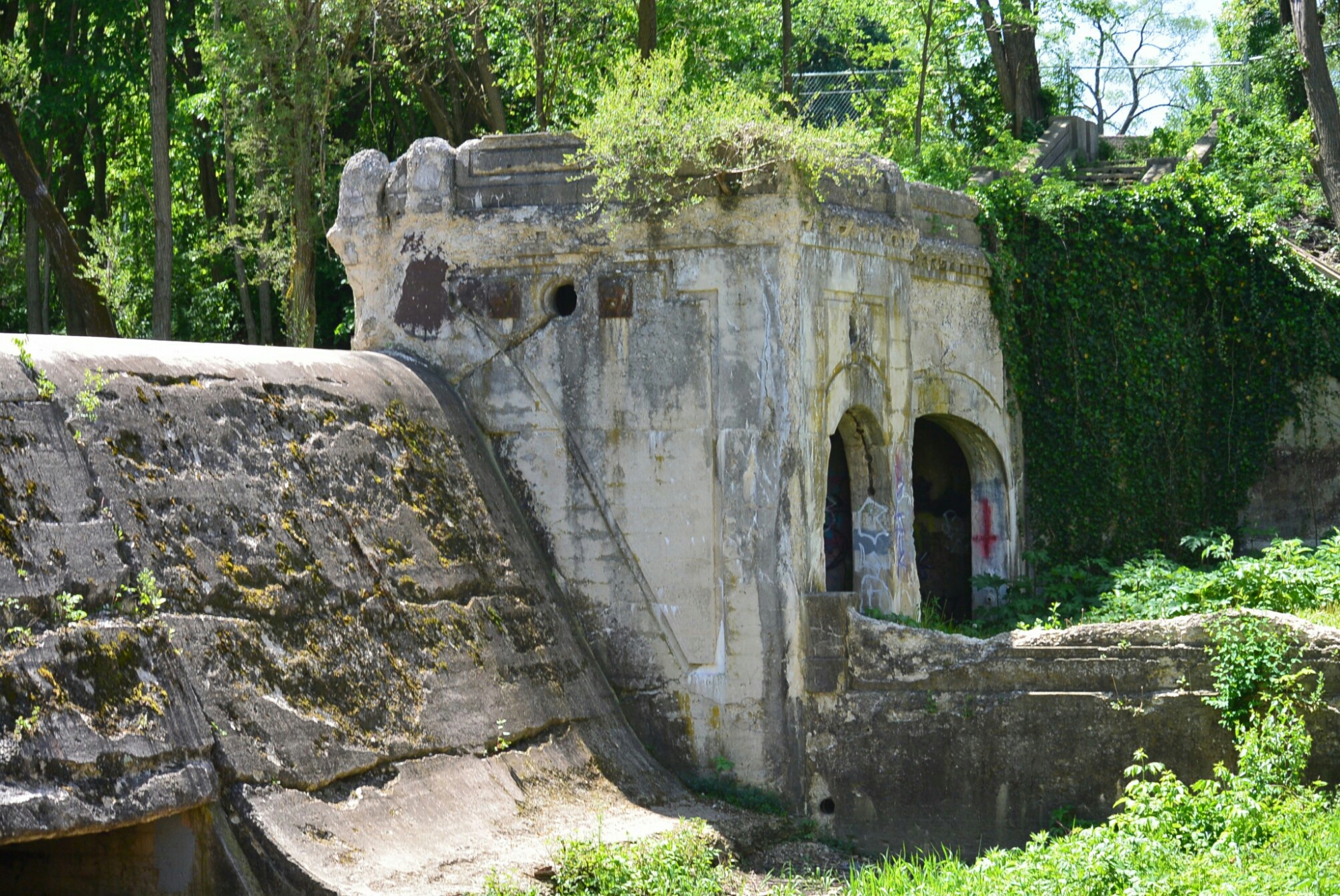
Dam Dellwood Park
Dam Dellwood Park
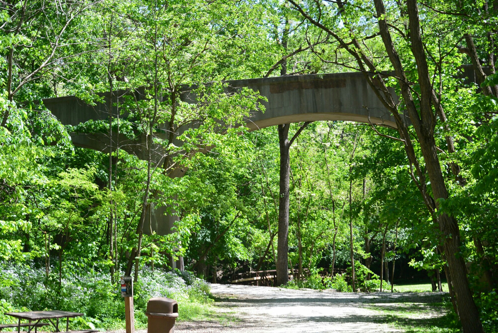
Unknown Bridge Dellwood Park
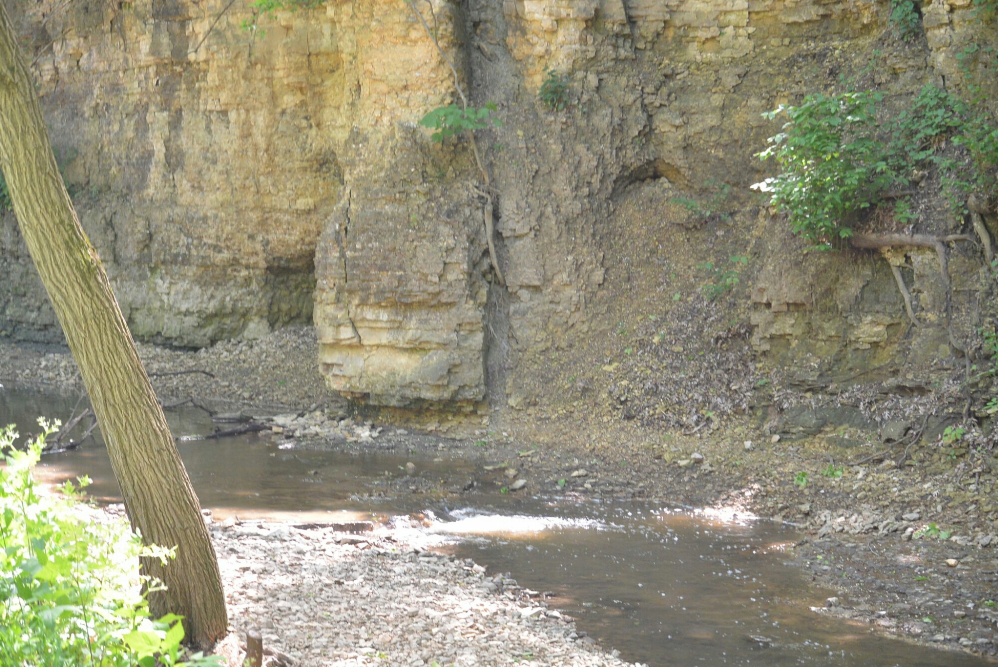
Limestone Bluff Dellwood Park
Dellwoood Park
Although not directly located on the Illinois Michigan Canal, Dayton was connected to it by the Fox River Feeder Canal.
Dayton is a small town north of Ottawa on the Fox River. In the 1800’s,it was quite an active community. It was the site of the first flour mill in the county. It was also the site of the first woolen mill run by water in the state of Illinois. It also had a tannery, saw mill, wagon shop, and a chair factory.
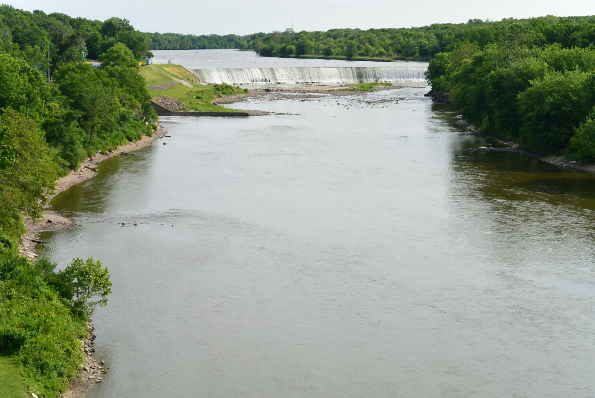
Near Dayton, a dam was built on the Fox River. It’s purpose was to force water into a feeder canal which intersected the Illinois Michigan Canal in Ottawa. The dam was 8 feet high and 470 feet long. It was constructed of 2 inch wood planks forming a crib filled with stones and gravel. The dam was subjected to the vagaries of the weather. It ultimately was completely destroyed in 1904. It was never rebuilt.
At the entrance of the feeder, there was a guard lock. It’s purpose was to regulate the water level. In this same area, there was a lock keeper’s house. The feeder canal was 4 feet deep and 40 feet wide. It was completed in the early 1840’s.
In 1925, a dam and power house were built on the Fox River at Dayton. This was a business for the production and sale of electrical power. The company name was North Counties Hydro-Electric Power. This facility operated continuously until 1996. It was out of commission until 1998. It resumed operations in 1998. It has functioned since. It was sold to North AmericanHydro, Inc.
The town of Dayton never prospered like adjacent Ottawa. The population was 553 in 2016
D
Dayton Hydroelectric Dam

Little Vermillion Aqueduct
I recently visited the Illinois State Archives in Springfield and compiled the following information about contractors working on the Illinois Michigan Canal.
Locks. Lock 3 Charles Wern
Lock 4 Grubb and Ford, Charles Wern
Lock 5 Wilson, Brodie and Co.
Lock 8. Mattison and Co.
Lock 9 Kennedy and Kilduff
Lock 11 Sanger, Beale and Cooper
Lock 12 Grubb and Ford, Armstrong and Johns
Lock 13 Whaley
Lock 14 Elliot and O’Connor
Lock 14
Lock 15 Cooper and Sanger
Lock 15
Feeder Canals were used on the Illinois Michigan Canal to maintain water levels. These canals were: Calmer Feeder, DuPage Feeder, Kankakee Feeder, and the Fox River Feeder.
The eastern most one was the Calumet Feeder. It extended from the Little Calumet River in Blue Island to the Illinois Michigan Canal at the Sag Bridge. It’s total length was 16.7 miles. Contractors working on the project were Clifford,Sistan, Odom, Norton, Blackstone.
The next western feeder was the DuPage Feeder. This was a very short channel linking the DuPage River to the I and M Canal near Channahon area. It was used for only a short time There is not much information available about this structure. Contractors were Harris and Johnston
The next feeder was the Kankakee Feeder.This extended from the Kankakee River near Wilmington to the I and M Canal in the area now known as McKinley Woods. Contractors included Perkna, Adams, Norton, Black, Pesrena, Adams, Blacktone, Dinwiddie.
The next feeder was the Fox River Feeder. It extended from Fox River in Dayton to the I and M Canal in Ottawa. Contractors included Green, Stratten, Donnevan.
The aqueducts were used on the Illinois Michigan Canal to cross existing rivers and creeks in the path of the canal.
The western most of the aqueducts crossed the Little Vermillion River in LaSalle. The age of the original construction is unknown. It’s length is 140 feet. At the time of my last visit summer of 2016, the aqueduct was being repaired. Contractors working on the project included Bryne, Cody, Cahill, Fleahill, Byron, and Howe.
The next most eastern aqueduct is the one over the Pecumsaugen Creek. Not much is known about its history. Contractors were Whaley and Brody.
Proceeding eastward, the next aqueduct encountered crossed the Fox River in Ottawa. Construction began in 1839. It was completed in 1842. The original structure had limestone piers and a wooden superstructure. The wood was replaced with iron in 1922. The aqueduct was the largest on the Illinois Michigan Canal. It measured 464 feet in length
At one time there was a towpath bridge, a wagon bridge, and an electric railroad bridge. The rail bridge was abandoned in in 1934. It was converted by the CCC into a new tow path bridge in 1935. The aqueduct currently carries no water.
The contractors working on the project included: Williams, Howe, Hall, Lord, and Sanger Construction.
Fox River Aqueduct
The next eastern aqueduct crossed Nettle Creek in Morris. It was between 80–90 feet in length. It was built in 1847. It originally had Redstone piers and a wooden superstructure. The piers were replaced with cut stones. The wood superstructure was replaced by iron. The aqueduct was destroyed by a flood in April, 2013. It has yet to be repaired. Contractors included Nettlebrok, Pierce, and Armstrong
Nettle Creek Aqueduct
The eastern most aqueduct is in Grundy County. It crosses the Aux Sable Creek. It was constructed in 1848. It was 136 feet in length and 18 feet in width. The original structure had limestone piers and a wooden superstructure. This was replaced by a steel structure in 1927. The limestone piers were extensively remodeled in 1948. Contractors were Matteson, Campbell, Lord, Wall, Sordslo, Kinsley.

Aux Sable Aqueduct
Aux Sable Aqueduct
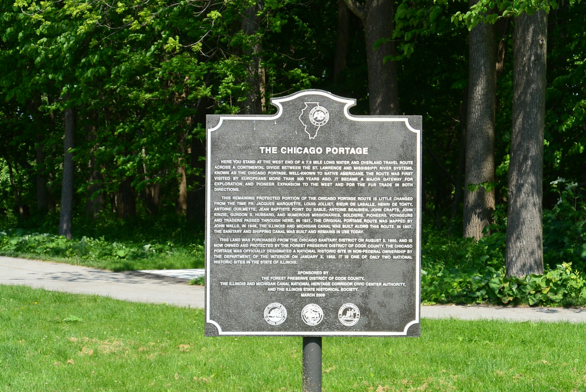
One of the unique geographic features of the Chicago area is the portage. This is a low level divide (sometimes called a subcontinental divide) separating the drainage of the Chicago River from that of the DesPlaines River. As a result of this feature, water flowed east in the Chicago River to Lake Michigan. Please note this pattern occurred until the man made reversal took place. Drainage in the Desplaines River is west towards the Illinois RIver. This geographic created a gap between the two rivers.
In the 1600’s, native Americans introduced this area to Joliet and Marquette. These two explorers were the first to propose some type of canal to bridge the gap. In the 1800’s, Gurdon Hubbard (an employee of the American Fur Company) encountered the portage during his annual trips between Michigan and the Illinois River.
In his autobiography, Hubbard described the difficulties faced in crossing this area. There was the thick mud. There were numerous leeches and mosquitoes. It could be quite an ordeal.
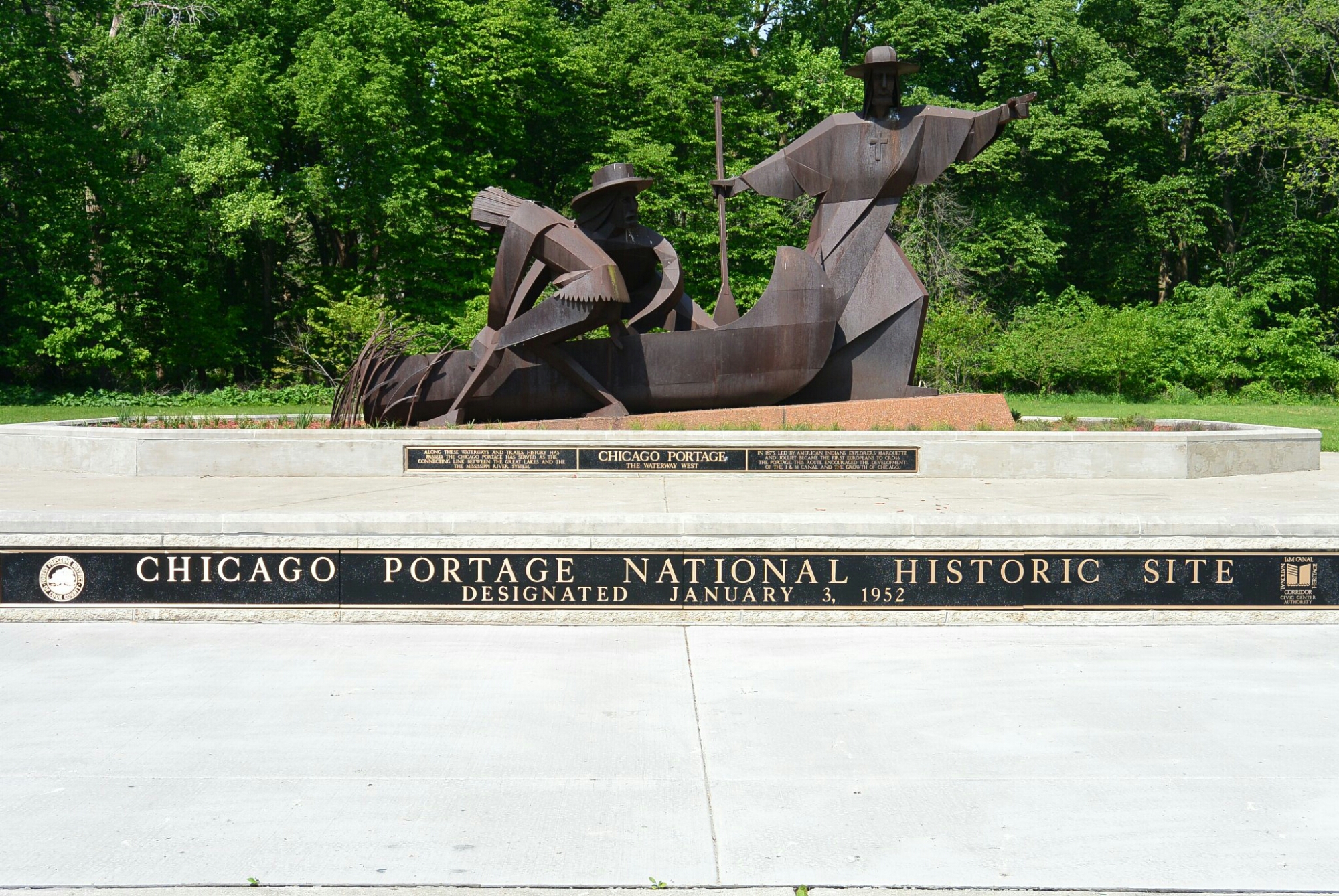
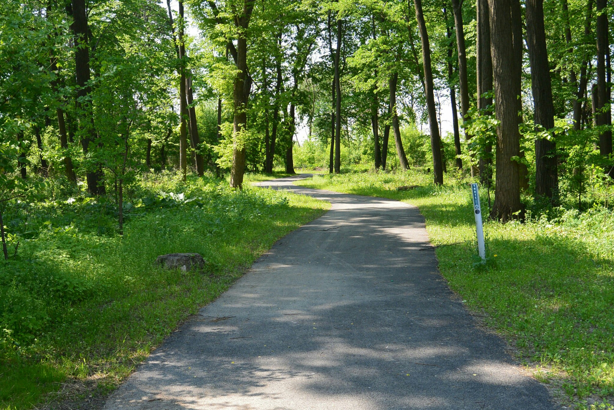
A portion of the portage site has been preserved at the Chicago Portage National Historic Site. This is located at the eastern end of the Illinois Michigan Canal National Heritage Corridor. The site is in a Cook County Forest Preserve in Lyons, Illinois. It is off Harlem Avenue. There is a memorial to Joliet, Marquette, and their Indian guides. There is informational signage. There is also a portion of the Portage Creek where it joined the DesPlaines River.
 Portage Creek
Chicago Portage National Historic Site
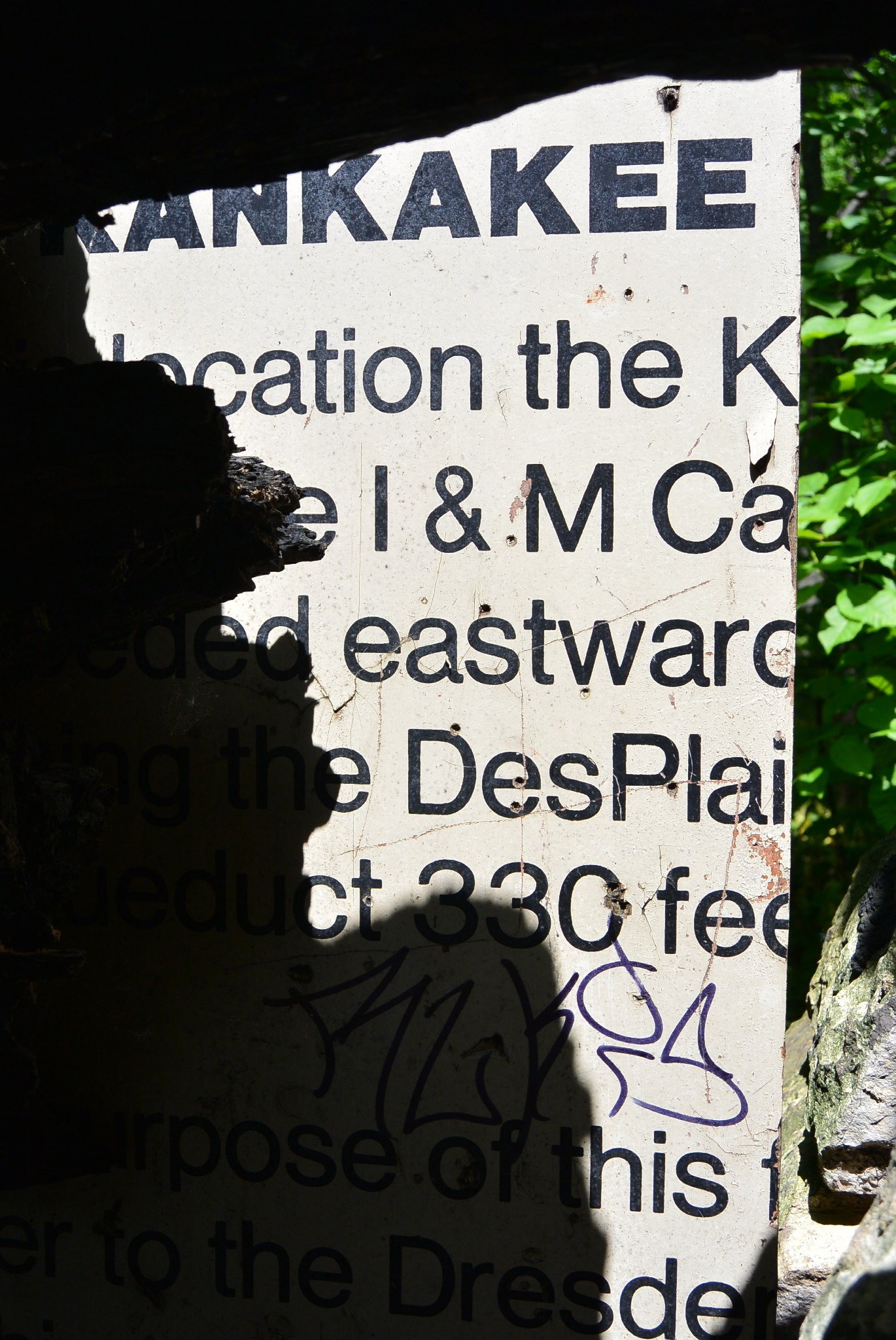
Sign describing Kankakee Feeder Aqueduct
During the construction of the Illinois Michigan Canal, it became evident that there was a problem with the water levels at Channahon. There apparently was excessive seepage of water through the underlying gravel. The first solution to this problem was the construction of a short feeder from the DuPage River to the canal. This however did not fix the low water levels. This short feeder was dismantled.
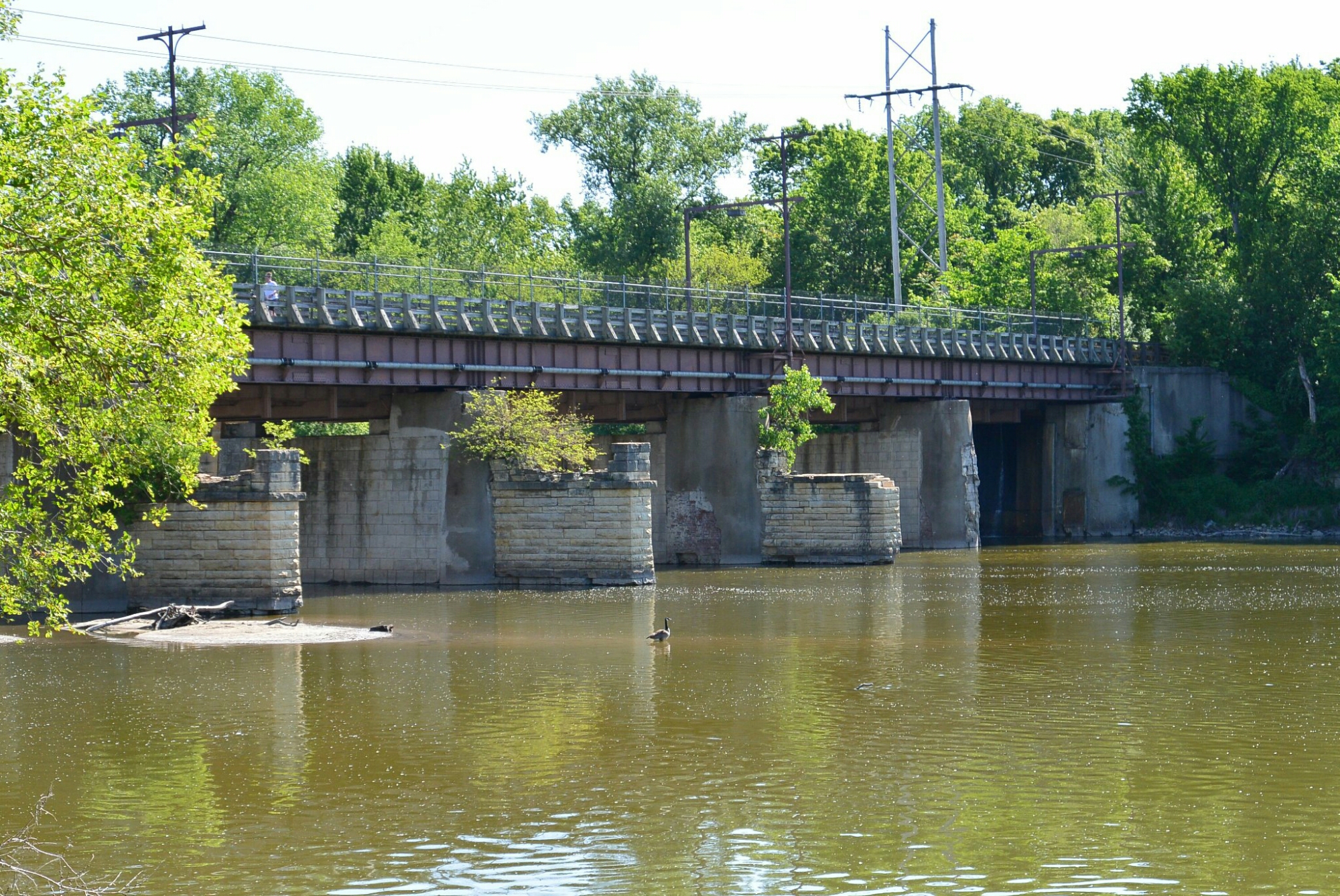
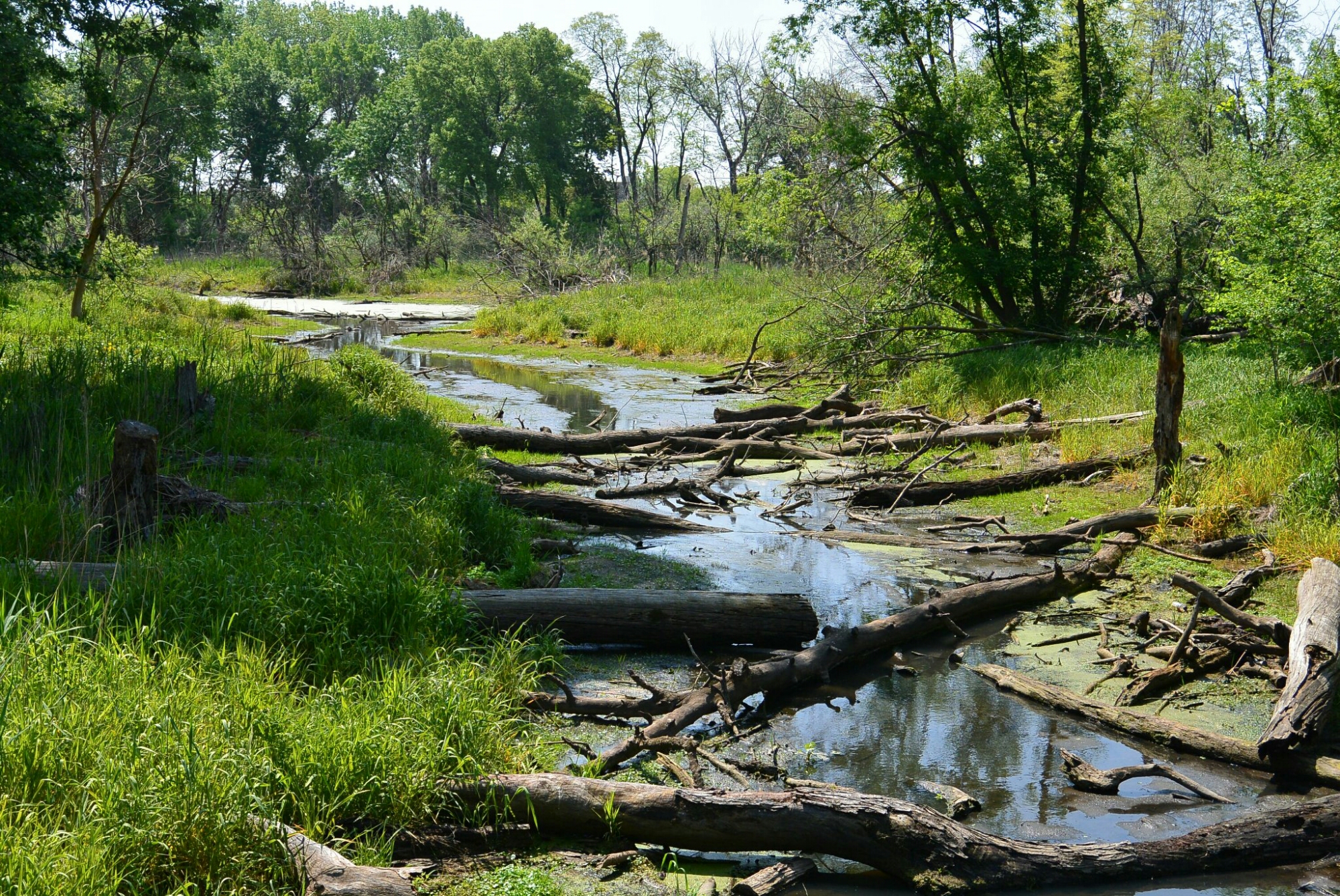
The next solution was the Kankakee Feeder Canal. A dam was built across the Kankakee River near the center of Wilmington Township. This was called the state dam. It’s purpose was to force water from the river into the feeder canal on the north bank. The course of this man made waterway was north and west. As it approached the DesPlaines River, it entered a wooden aqueduct with limestone piers. This crossed the river and entered the Illinois Michigan Canal. This was in the area of McKinley Park.
McKinley Park near the site of the former Kankakee Feeder aqueduct over the DesPlaines River
With the opening of the Illinois Michigan Canal, citizens in Wilmington and in other areas along the Kankakee River sought to make changes to make the river navigable. There were several unsuccessful attempts. Interest in the project also wanned as the promise of a railroad developed.
In 1870 a group of investors from Massachusetts sought to complete the work on the Kankakee canal. It was completed in a timely fashion. When done, it spanned 21 miles from Warner’s landing to the Illinois Michigan Canal. The completed project included: 1) raising the level of the state dam by 2 feet: 2) dam and lock a mile upstream; 3) 14 foot earthen dam at Wilmington; 4) over flow dam at the island at Wilmington; 5) 16 foot dam 950 feet long a mile above Wilmington; 5) lock just south of the highway bridge at Wilmington. The locks were made of limestone. The locks accommodated 100 feet by 18 feet. Early on barges were towed by horses. Later steam ships were used.
Unfortunately, the canal was not in service for a long period of time. The dams and locks were damaged by flooding and ice. They were never rebuilt.
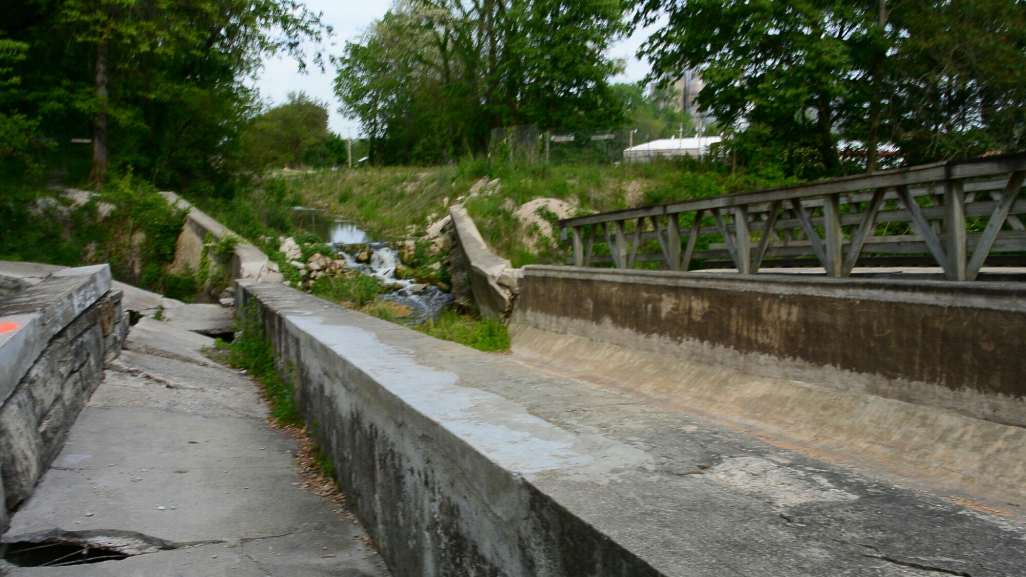
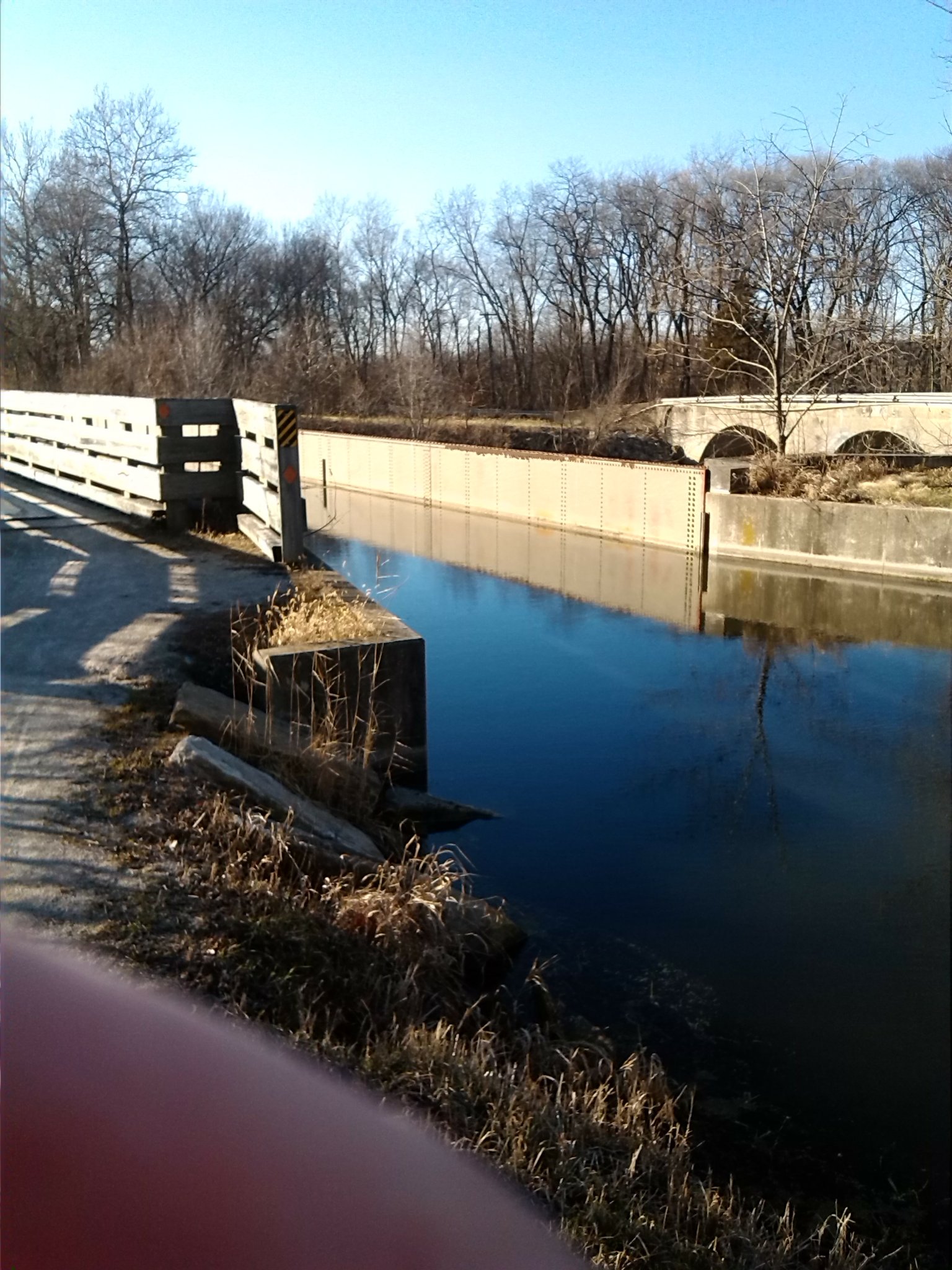
The Illinois Michigan Canal at Channahon is an interesting region. It is at this site that Locks 6 and 7 are located. The DuPage River crosses the Canal. During construction of the Canal several options were considered for this region. First consideration was for an aqueduct to cross the River. This option was used at other sites of rivers crossing the canal. However, this option was discarded as too expensive. Next consideration was for a feeder canal. This was built. The contractors were Harris and and Johnston. This canal extended from the DuPage River near Minooka to the area near Lock 7. Eventually, this was taken down. In its place, a dam was built across the DuPage River between the two locks. A control gate was created adjacent to Lock 7. This allowed water from the River to enter the Canal. This set up exists until present time.

Lock 7
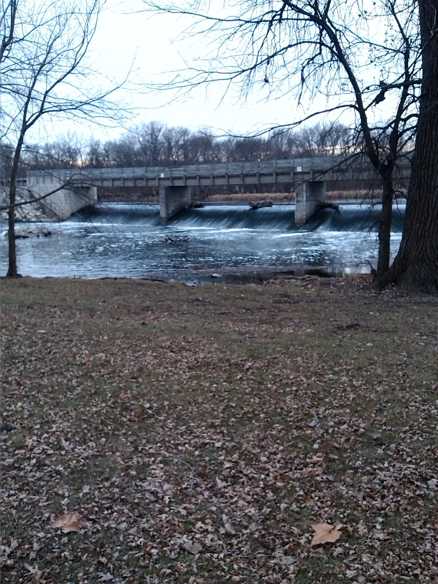
Dam on the DuPage River
Lock6
Lock 7
Lock 7
Lock 7
Lock 7
Lock 7 is located in Channahon, Illinois on the west side of the DuPage River. It was one of the original 15 locks on the canal. It was constructed in the time period between 1846-8. It is 110 feet in length and 18 feet in width. It walls were made with ashlar limestone. The lock gates were made of timber. The lift was 3.9 feet. On the western side of the lock stood an office and shelter for the lock tender. It had clap board walls and a wood shingle roof. This was demolished in 1910
Adjacent to Lock 7 is a control gate that allows water into the canal from the DuPage River. Originally, there was a feeder canal that extended from the DuPage River in Minooka to the area around Lock 7.
The lock gates were eventually removed. A concrete barrier was installed on the east end of the lock in 1956.
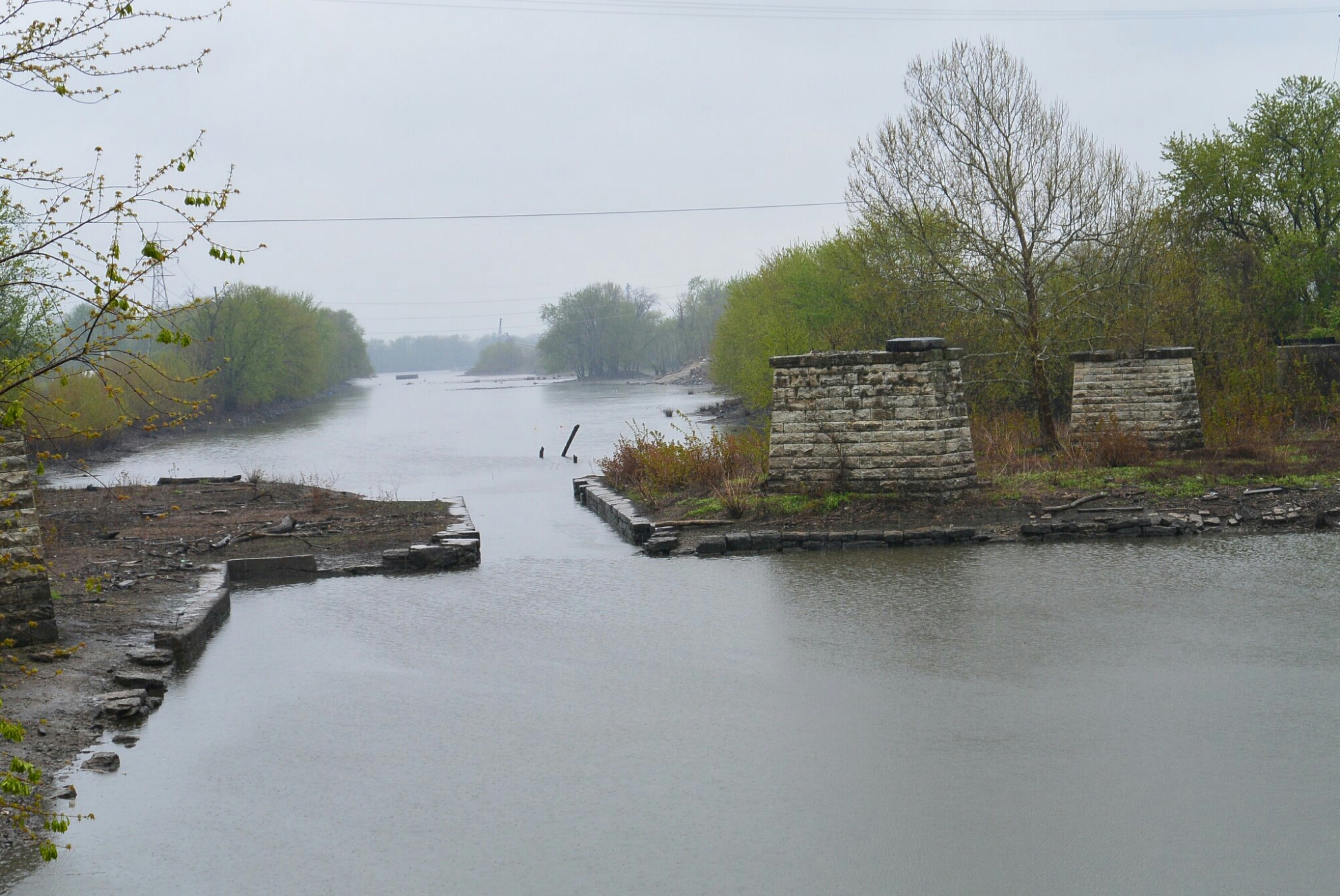
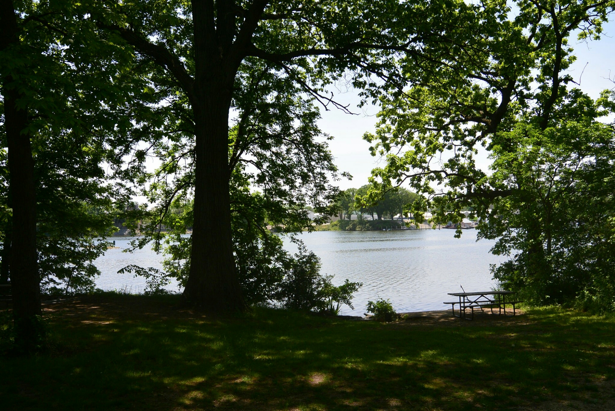
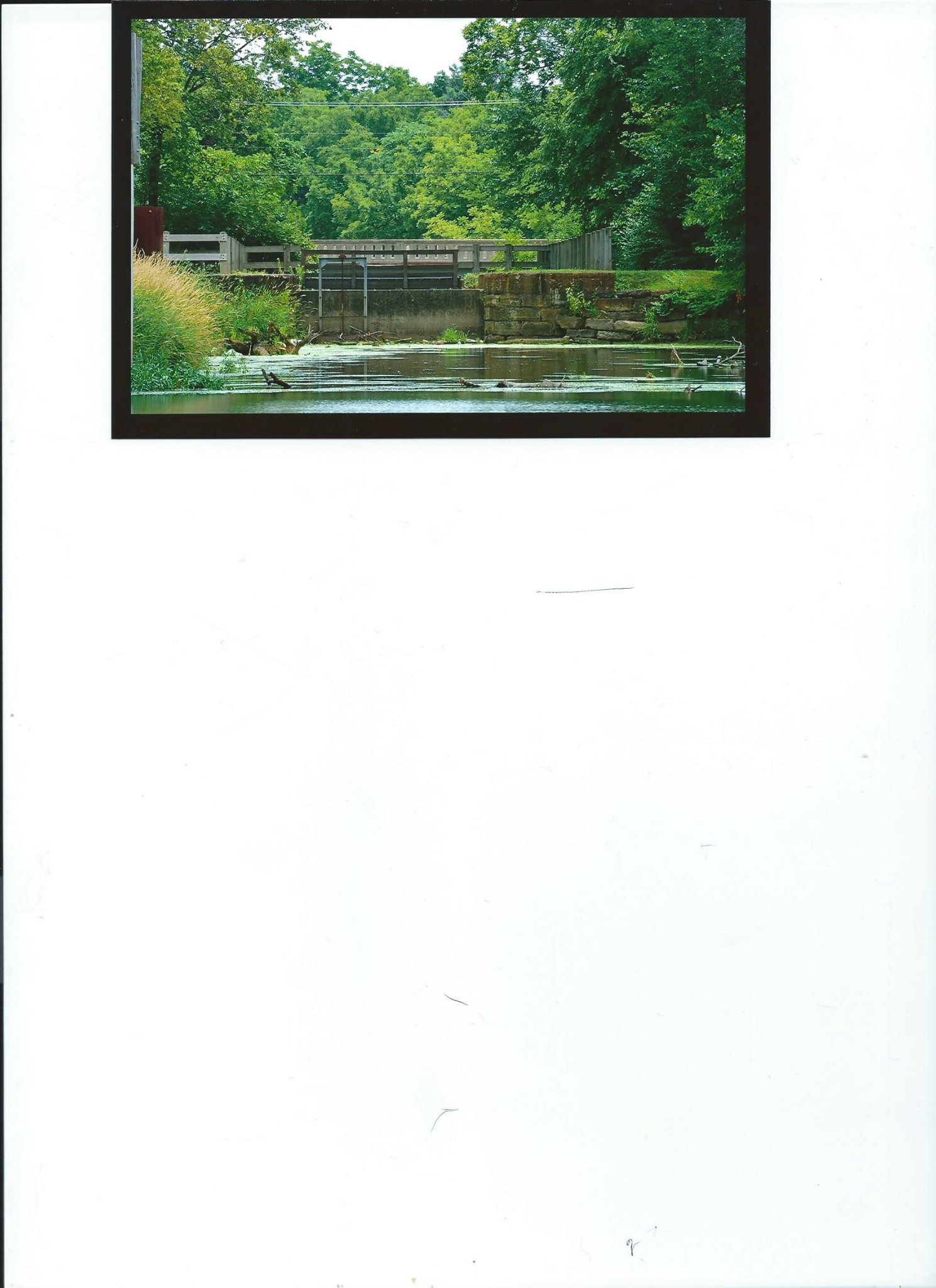
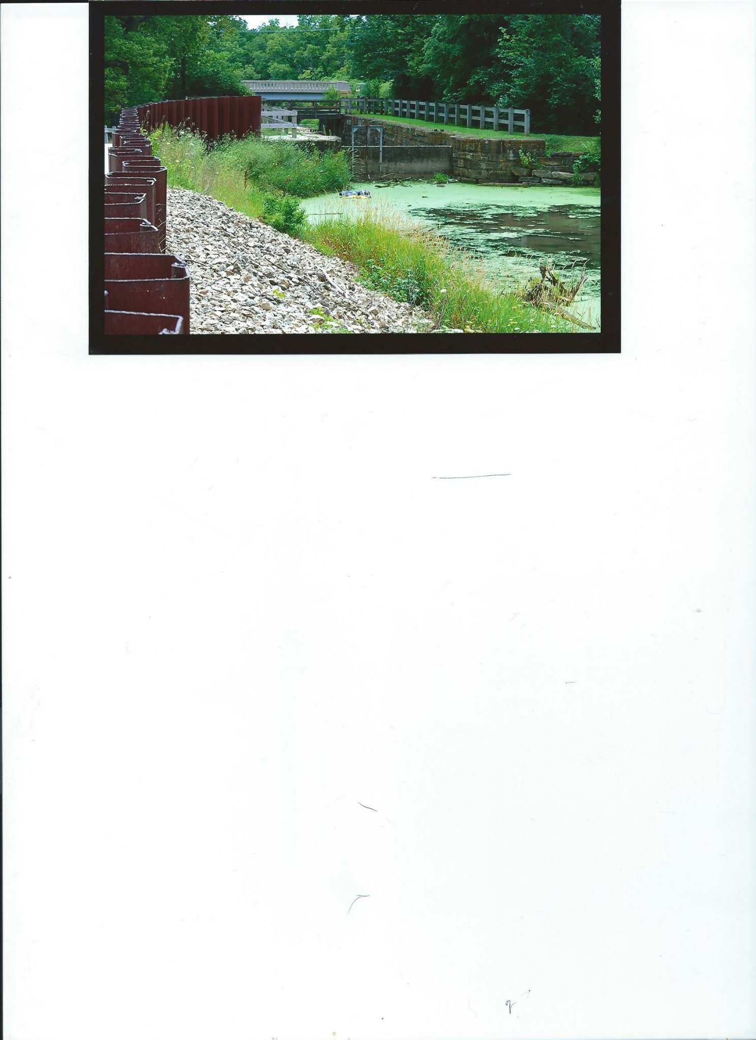
One of the unique features of the I and M Canal in Ottawa was the Lateral Canal. This was a canal that wound its way through the city. It was a method of providing hydraulic power to many businesses located there. It originated at the junction of the Fox River Feeder and the main I and M canal. It went south until it reached the area known as the Hydraulic Basin. Here it changed direction and headed east until it reached the Fox River and there discharged its water. This site was near the Ottawa Boat Club.
Currently, some bridge footings near the site of origin are the only remnants of the Lateral Canal.
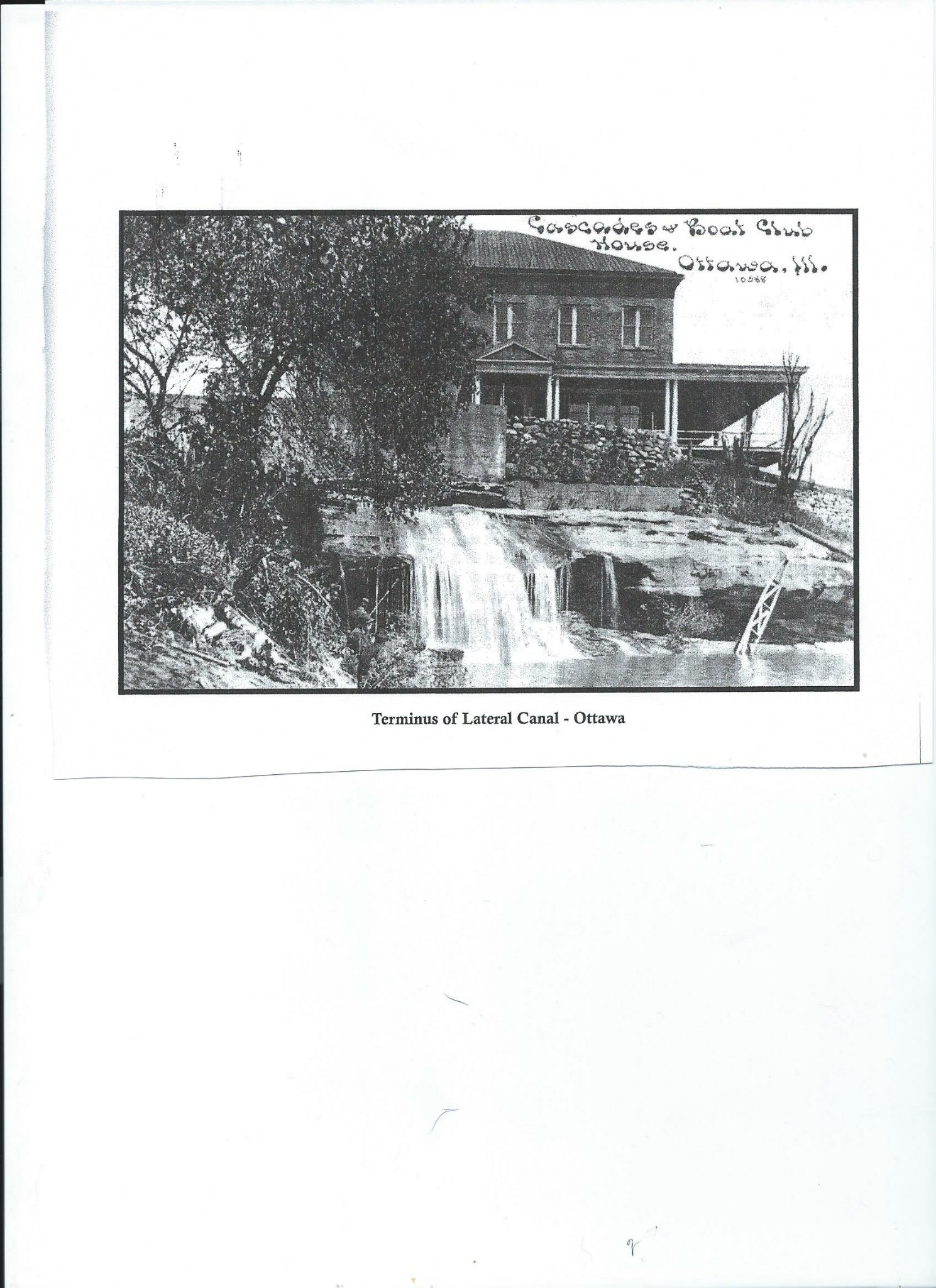
Terminus Lateral Canal
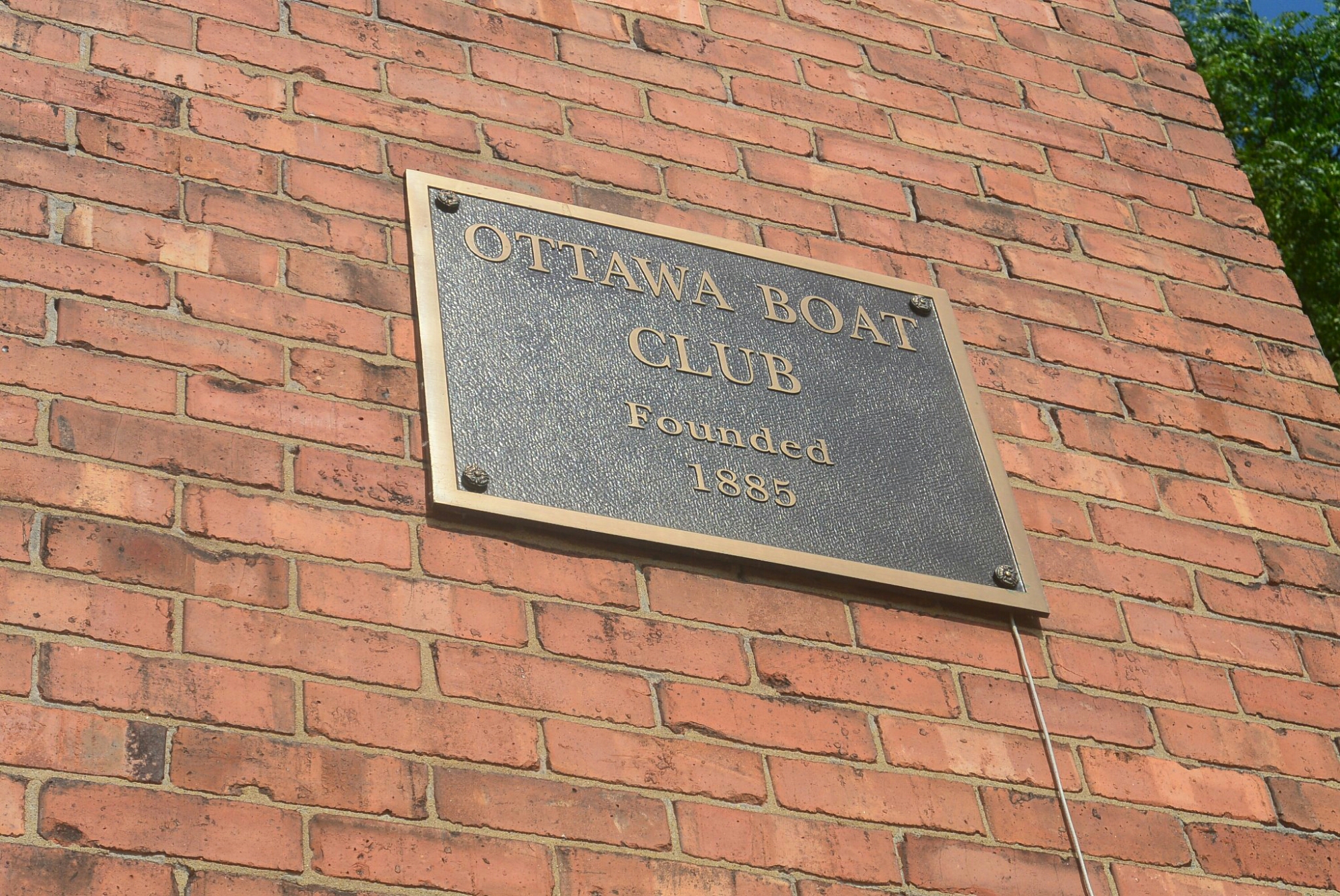
Ottawa Boat Club. Current
Lock6
Lock 6
Lock 6 is one of the original deep cut locks on the Illinois Michigan Canal. Its length is 110 feet; width 18 feet. It was designed to have a lift of 11.8 feet. The original lock gates were made of timber. The walls of the lock are limestone. Concrete was used for patching deteriorated limestone. The lock was originally completed in 1847. It was reconstructed in 1885 and in 1936. The lock was extensively refurbished by the CCC during the 1930’s, The original lock gates are no longer present. A concrete barrier was constructed at the north end of the lock in 1956. There is a wooden foot bridge across the lock to the locktender’s house.
The lock is located in Channahon, Illinois on the east side of the DuPage River.
Lock 6
Lock 6

Lock 6
