Mule Barn 2

     From 1848 to 1871, boats traveling the Illinois and Michigan Canal were towed by either horses or mules.  Steam powered boats were not used on the canal until 1871.  Horses were mainly used on the passenger boats also known as packet boats.  These moved at a rate of approximately 5 miles per hour.  The boats had a short history on the canal (1848-1853)  They eventually were replaced by the Rock Island Railroad.  This was much faster and operated year round.
     Cargo canal boats were towed by a team of 2 to 5 mules. They traveled at a slower pace–2 miles per hour. The mules were a much more hardy animal and could work in shifts of six hours.  The team of mules was
image

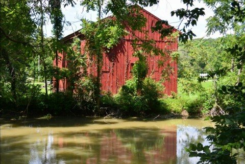
Rutherford Mule Barn Dresden I and M Canal

attached to the canal boat by a 150 foot line.
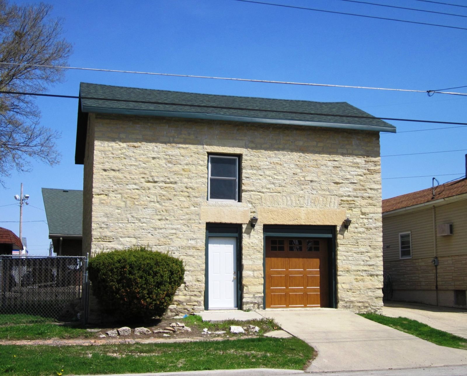
     Along the canal, at 12 to 15 mile intervals were mule barns.  It was at this site that mule teams were switched so that there would be fresh animals for the next 12 to 15 miles.
image

Mule Barn along the Lateral Canal Ottawa
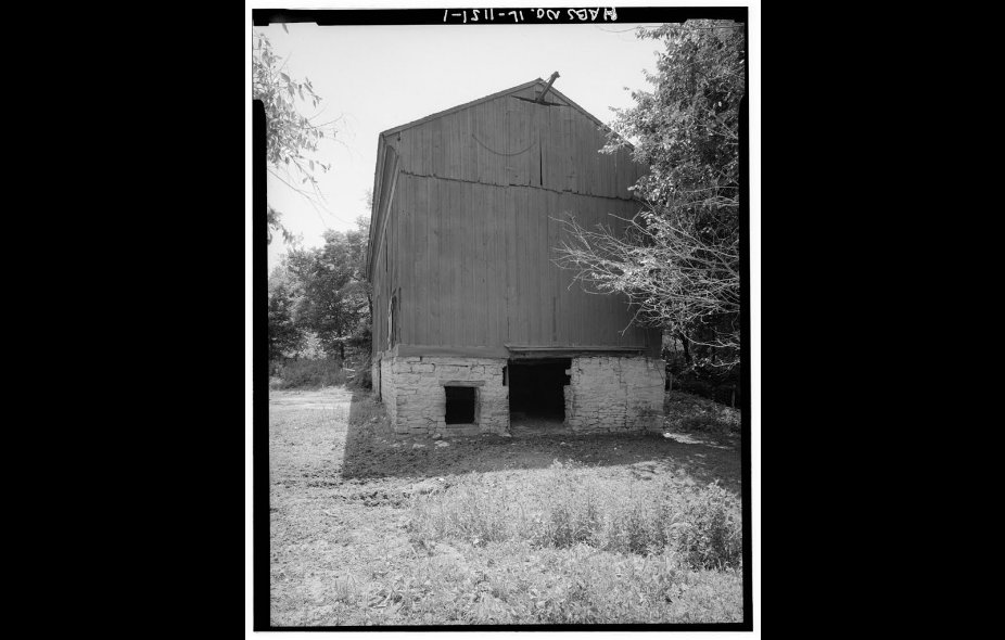
Mule Barn

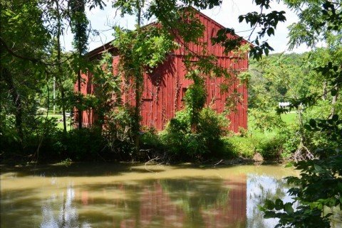
     In the Dresden Access of the Illinois Michigan Canal, as one walks down the trail, a large red barn is seen on the north side.   A sign identifies this as the last remaining mule barn of the canal.
     This barn was owned by Salmon Rutherford.  It was built in stages beginning in the 1830’s.  It was built of heavy timber, posts and beams.  The foundation was limestone.  It measures 65 by 26 feet.  An unusual feature is that the barn is on the opposite side of the canal from the tow path.  In addition to serving as a mule barn, the structure was used as a granary to store grain in sacs for later shipment on the canal.

image

Rutherford Mule Barn

image

Rutherford Mule Barn.


image

Dresden Inn or Rutherford Tavern

Who is Salmon Rutherford? He appears to be the first settler of Aux Sable Township arriving there around 1833. He had a farm on Section 26 of the township. He became a leader in township affairs. In 1834, he constructed an inn on the north side of Hansel Road opposite the Dresden Barn. It was known as the Dresden Inn or Rutherford Tavern. This became a stop on a stage coach line between Chicago and Ottawa. Mr. Rutherford charged 12 and one half cents for for an overnight stay and a similar amount for care of a horse. Two years later, a second hotel was built in the area as well as a post office. In 1936, Rutherford platted the town of Dresden. It had approximately 150 residents. There was a ferry business on the Illinois River; there were clay pits that supplied material for manufacturing tiles and bricks. Workers migrated to the region during the construction of the Illinois Michigan Canal and the railroad in Minooka. The population of the town began a decline after canal construction and the railroad construction were completed. Ultimately Dresden became a ghost town.

Buffalo Rock State Park

     Buffalo Rock State Park is an Illinois State Park.  It is located on Dee Bennett Road.  It is between Utica and Ottawa in LaSalle County.  The park is located on a bluff which is adjacent to the Illinois River.  It is approximately 298 acres.
    This is a historical site.  It was the home of the Illinois Indians in the 1600’s.  It is thought that Buffalo Rock was a French military and trading post as well as a missionary site.  More recently the site was used by a religious sect for meetings.  It was also used for a tuberculosis sanitarium.  From 1916–1928, the site was owned by the Crane Company of Chicago.  They used it as as a sanitarium for sick employees and a vacation ground for its workers and their families.  The Crane Company deeded the land to the state of Illinois in 1928.  The terms of the transfer were that the site would be a permanent state park.
     The park is known for its panoramic view of the Illinois Valley and River.  There are also two buffaloes kept on the site.

image

Panoramic View Illinois River

image

View Illinois River

image

Buffalo Rock

image

Buffalo Rock

image

Buffalo at the park.

image

Split Rock

Split Rock Part
     As we proceeded further west from Utica on the Illinois Michigan Canal, we reached

image

The region of Lock 13. 
This area is not marked.  We saw an area that could possibly represent the remains of the lock.
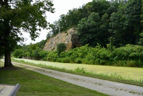
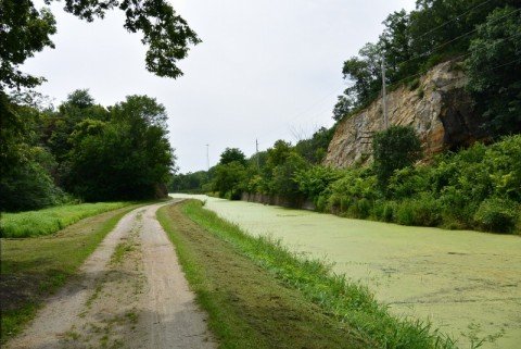
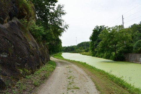
     Approximately 2.5 miles west of Utica is the actual area of the Split Rock.
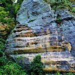
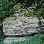
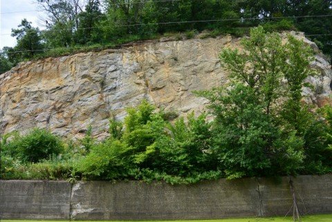
     The Split Rock is a gap in a ridge for the passage of the I and M. Canal.  It was built between 1836 and 1842.   It was built with black powder, picks and shovels.  In the 1850’s, the Rock Island Railroad built a tunnel through the north bluff.  In 1882, the canal was partially filled in and part of the north bluff was removed for a second set of tracks for the Rock Island. A third set of tracks was built in 1952.  The track through the tunnel was abandoned at this time.
    In 1903, the Chicago, Ottawa, and Peoria R.R., built two bridges to allow passage over the canal and the Rock Island Railroad tracks.  These bridges are no longer present; they were removed after the railroad went bankrupt.  At one time, there was a beer garden and a dance pavilion on the north bluff.

image

Split Rock with Tunnel in the North Bluff

image

Split Rock

image

Split Rock

image

image

Split Rock

Joliet Correctional Center

     The Joliet Correctional Center (also known as the Joliet Prison) was a prison located in Joliet, Illinois.  It was in operation from 1858–2002.    The architects were Boyington and Wheelock.    Mr. Boyington also designed the Chicago Water Tower.  The prison was constructed with convict laborers from the Alton Prison under the supervision of the contractor Lorenzo Sanger and the warden Samuel K. Casey.  The first 33 inmates arrived from Alton in May of 1858.  The limestone used in the construction was quarried on the site. 
     The last prisoners from Alton were transferred in 1860.  During the Civil War, both criminals and prisoners of war were confined at the facility.
     The prison population reached 1,239 in 1872.  The inmates were contracted to work at local businesses.  There was slow modernization of the facility.  Running water and toilets were late in coming. 
     The number of inmates peaked in 1990 at 1300.  It was 1,156 in 2000.  The facility closed in 2002 citing budget cuts and the dangerous and obsolete nature of the buildings.
   The facility was used in the filming of “The Blues Brothers ” with John Belushi.  It was also used in the Oliver Stone movie “Natural Born Killers” as well as the tv series “Prison Break”
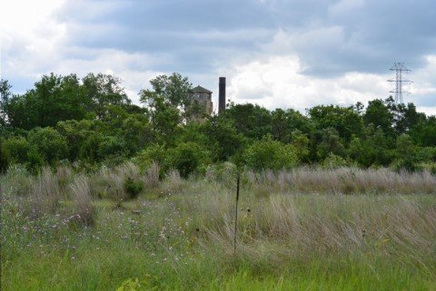
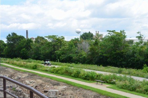
     The prison can be seen from the path along the Illinois Michigan Canal in Joliet.

image

One of the towers of the Joliet Prison can be seen in the distance.

image

The Joliet Prison can be seen in the distance.

LaSalle Mission Cemetery.

     One of the more fascinating stories of the LaSalle region was the rediscovery and excavation of this region. 
     LaSalle Mission Cemetery was blessed and dedicated in 1840.  It was founded by the Vincentians–a Catholic religious order.   It was nominally under the control of the diocese of Saint Louis.  It was in use from 1840 to 1857.  The majority of the people interred here were Irish immigrants.  There were also a far amount of Germany immigrants.  Considering the time it was active, it is a fair assumption that many of the people interred here had worked on the Illinois Michigan Canal in one capacity or other.
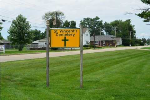
     The last known burial here was in 1857.  This cemetery fell in to disrepair and was forgotten.    The site was recently to become veterinary office at 24th and Charters Street in LaSalle, Illinois.   During excavation, human remains were found.  Subsequently, a voluntary effort was begun to excavate the human remains and re-inter them at Saint Vincent Cemetery.
John Hurst-a local funeral director had been helping the effort with volunteers.  There was also supervision with an archeologist. 
     The project was completed in April of 2012.  The remains of over one thousand individuals were found. They were relocated to 10 grave vaults at Saint Vincent Cemetery.

image

image

In June of 2012, Bishop Daniel Jenky and two local priests presided at a grave Site ceremony.
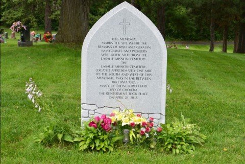
     In March of 2013, a granite memorial was installed at the grave Site.  The inscription read:  The memorial marks the site where the remains of Irish and German immigrants and pioneers were relocated from the LaSalle Mission Cemetery.  The LaSalle Mission  Cemetery, located approximately one mile south and west of this memorial, was in use between 1840 and 1857.
Many of those buried here died of cholera.  The re-internment took place on April 28, 2012.

.

Final Day Canal Walk.

     On the final day of the canal walk, we started out in Ottawa.  We walked east and west along the site of the canal.  For the most part the canal bed is dry.  We passed by the toll house.  This is apparently the last surviving one.  We made our way to the aqueduct over the Fox River.  During its history, this carried the water of the Illinois Michigan Canal, a wagon bridge and an electric railway.
    We then traveled to the small town of Seneca.  The Canal here is dry.  We took pictures of the Hogan Grain Elevator.  Thus ended our travels.

Split Rock

There is a 2.4 mile section of the Illinois Michigan Canal west of Utica that is steeped in history.  First encountered is a deserted railroad bridge. This was apparently built by the Rock Island and later abandoned.

image

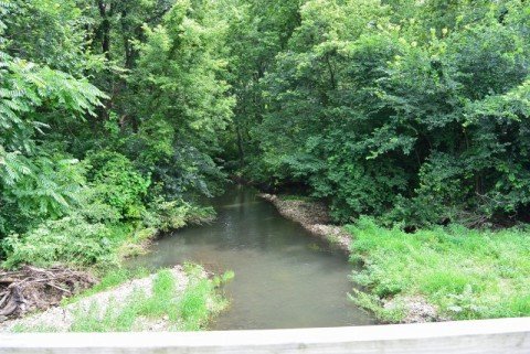
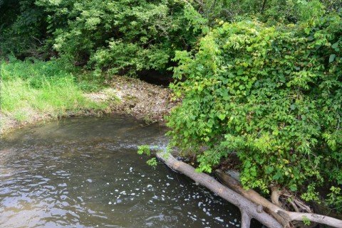
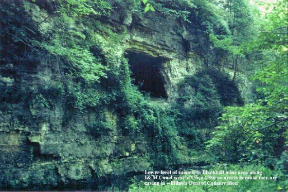
     Approximately one mile west is the Pecumsaugan Creek.  There is the creek itself.  North of the canal and railroad tracks along the creek is the area of the Blackball Mines.  This is a restricted area managed by the DNR.  It contains abandoned limestone mines.  It is also known for its collection of rare bats.
John Clark, the engineer in charge of the construction of this section of the Illinois Michigan Canal, discovered limestone deposits in the cliffs next to the canal.  This was an important discovery because this was used to manufacture hydraulic cement. When limestone is heated it decomposes to a natural cement (hydraulic cement). This hardens under water.
Norton and Steele built a mill in 1838 to supply the I and M canal with hydraulic cement during its construction. This was sold to Mr. Clark it in 1845 and he founded Utica Hydraulic Cement Company.  Other mines were established in this area.  One was Blackball mine.  Utica Hydraulic purchased these mines. The cement company continued in business until to 1947.

   On our trip these mines were not readily apparent apparently obscured by trees and foliage.

image

image

image

image

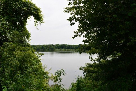
South of the canal between the canal and the Illinois River is Split Rock Lake

image

image
Flooded Split Rock Lake.

The Split Rock and Lock 13 will be dealt in part 2

Father Marquette

Jacques Marquette was born in Laon, France on 6/1/1637.  At the age of 17 he became a Jesuit.  For 12 years he studied and taught in Jesuit Colleges in France.  He was then sent to Canada to be a missionary to the indigenous native population.  He excelled in knowledge of the languages of the Indian peoples.  In 1668, he established a mission in the western great lakes region at Saulte Ste. Marie.  This was followed by a mission at Saint Ignace in 1671.
     In 5/17/1673, he and Louis Jolliet and 5 men were chosen to lead an expedition to the mouth of the Mississippi River.  Marquette was the missionary; Jolliet was the lawmaker and explorer.
     They traveled west to the area that is now known as Green Bay, Wisconsin.
They navigated the Fox River; portgaged to the Wisconsin River.  They reached the Mississippi River at Prairie du Chen.  They then navigated southward to the Arkansas River.   They stopped their exploration at this site when they received reports of Spanish Settlers in this region. 
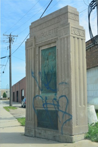
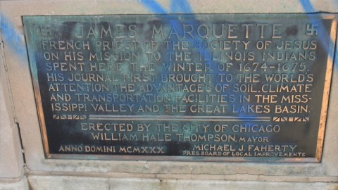
     It was their intention to return back along the Mississippi River route. Native Indians at the Illinois River told them of a shorter route along this river and the DesPlaines River with a portgage to the Chicago River.  Jolliet returned to Canada.   Marquette and two companions stayed at Green Bay.  In the winter, the group camped in Chicago.

image

image

Winter camp site 1674--1675. Damien Street Bridge Over the Sanitary and Ship Canal

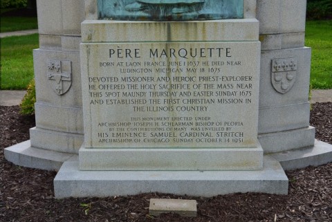
     In the spring of 1675, Marquette and his party returned to the area near Starved Rock.   A bout of dysentery forced him to return home.  He died on May 18, 1675.
Marquette and Jolliet were pioneers in the exploration of the Illinois Valley Region. Jolliet was the first to propose a canal to provide for a continuous link between Lake Michigan and the Illinois River.

image

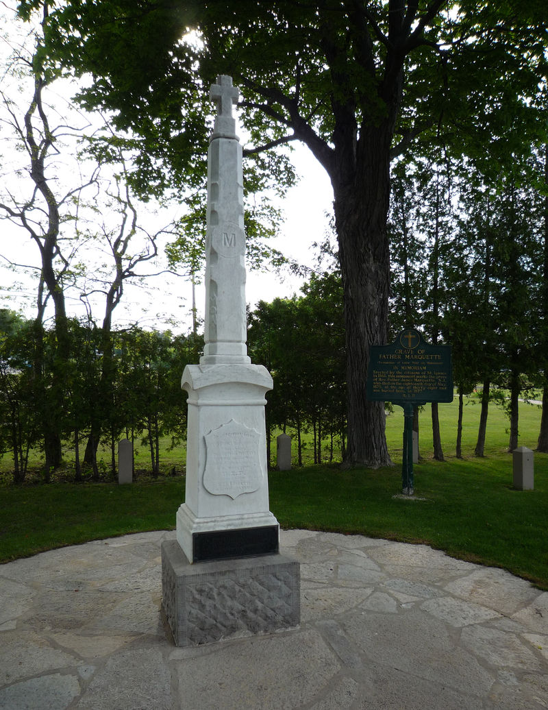
Marquette grave Site St. Ignace

image

Exact site of death not known.

image

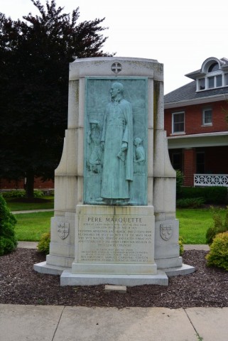
Marquette Memorial Utica, Il

image

Marquette Memorial Utica, Il