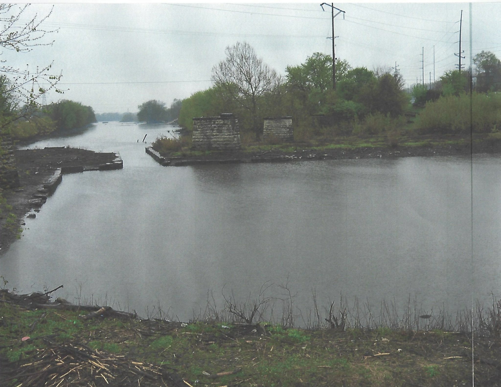
The I and M Canal was approximately 95 miles from the south branch of the Chicago River to the Illinois River in LaSalle, Illinois. In the picture above, the proximal waterway was the canal boat basin. It was at this site that the boats were unloaded to be reloaded in steamboats. These were located in the distal waterway which was known as the stream boat basin. These boats then traveled down the Illinois and Missippi Rivers.
The steam boats that arrived in the basin were unloaded and their cargo was reloaded in canal boats that traveled east down the canal.
The narrowed area on the image represents the site of Lock 15. This was the last lock on the canal.
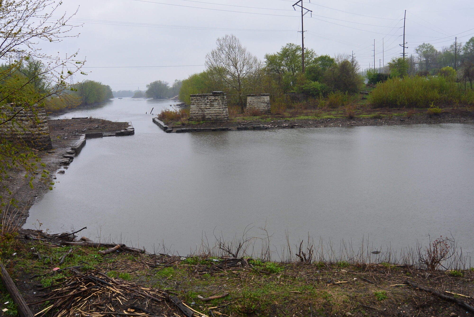
This photo provides a more complete view of the canal boat basin. Also seen is Lock 15. The limestone pillars were from a railroad bridge of the CBQ RR.
